Area Overview for Ribbleton Ward
Photos of Ribbleton Ward
Area Information
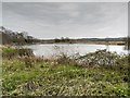
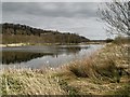
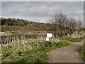
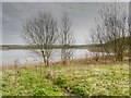
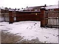
Ribbleton Ward forms part of the Preston district unitary authority in Lancashire, representing a specific district and borough unitary ward within the city of Preston. This locality covers an area size of 7.4 km², providing a contained environment for its 1,761 residents. The ward occupies coordinates 53.776447, -2.644986, historically rooted as a township in Preston parish. You are looking at a neighbourhood that has existed since at least 1201, when Henry de Ribbleton died possessing the manor. The area was first described in 1887 as mostly falling within the borough of Preston before being largely absorbed around 1871. Daily life here reflects a population density of 238 people per km². This figure indicates a residential setting with moderate population concentration. The ward previously included Ribbleton Hall, a steel-framed mansion built in 1865 for Thomas Birchall. This proposed location offers proximity to Grange Park, where the hall's remains currently stand. Residents benefit from historical features like Ribbleton Moor, which was enclosed in 1870. Living in Ribbleton Ward means accessing this specific electoral ward's history while navigating modern district boundaries. The area's character is defined by these 649 acres, which first appeared in records as part of the manor's lands. You will find yourself in a setting that blends medieval origins with Victorian development.
- Area Type
- District Borough Unitary Ward
- Area Size
- 7.4 km²
- Population
- 1761
- Population Density
- 238 people/km²
Demographics
The community in Ribbleton Ward displays a distinct age profile, with a median age of 70 years. This suggests the neighbourhood serves as a location for older residents seeking more space and quieter surroundings. The most common age range data indicates a significant proportion of the total population falls into older demographics. Consequently, you should expect a community where long-term residents dominate the local scene. Home ownership levels stand at exactly 50%, meaning half of the residents purchase their residences. This statistic places Ribbleton Ward in a balanced position between owner-occupied and privately rented markets. Household composition and accommodation type data reflect the settled nature of this ward. The total household and accommodation figures support the view of a stable community rather than a transient rental hub. While specific details on household size vary, the overall structure supports smaller, independent living arrangements typical of towns with high median ages. Ethnically, the predominant group within the total population shapes the cultural fabric of Ribbleton Ward. Religious adherence follows the total demographic breakdown common to the wider district. You will find a neighbourhood where generational continuity is evident. The 50% ownership rate means you can find homes suited to buyers or potential owners looking for stability. This demographic split ensures that half the market targets owners, while the other half relies on rental agreements. The age profile fundamentally influences local services and social activities available to you.
Household Size
Accommodation Type
Tenure
Ethnic Group
Religion
Household Composition
Age
Household Deprivation
NS-SEC
Explore more demographic insights in this area
Go to Demographics tabPlanning
Planning Constraints
- Flood RiskPremium
- Ramsar Wetland SitesPremium
- Area of Outstanding Natural BeautyPremium
- Protected Nature ReservePremium
- Protected WoodlandPremium
- Crime RiskPremium