Area Overview for Rawtenstall
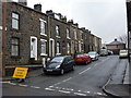
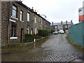
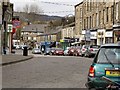
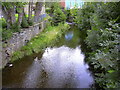
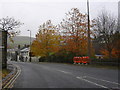
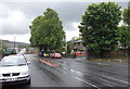
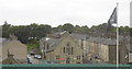
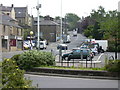
Photos of Rawtenstall
Area Information
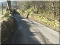
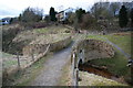
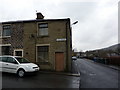
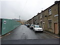
Living in Rawtenstall offers a blend of practicality and proximity to essential services within a compact 7.1 km² area. The town is home to a population with a median age of 70, suggesting a community shaped by long-term residents and a quieter, more stable rhythm of daily life. Its position as a built-up area means it balances local character with accessibility to nearby towns like Ramsbottom and Accrington. Residents benefit from a range of amenities within walking or short driving distance, including retail outlets such as Asda and Lidl, and multiple rail stations providing links to regional hubs. Digital connectivity is strong, with broadband scores near 100 and mobile coverage rated good, supporting both home-based work and everyday internet use. While Rawtenstall may not be a bustling commercial centre, its compact size and well-connected transport options make it a viable choice for those prioritising convenience and a slower pace of life. The area’s schools, from nurseries to primary institutions, cater to families, while its older demographic profile hints at a community with a distinct sense of continuity. For buyers seeking a manageable, well-served town with a focus on stability, Rawtenstall presents a compelling case.
- Area Type
- Built Up Area 250
- Area Size
- 7.1 km²
- Population
- Not available
- Population Density
- Not available
Daily life in Rawtenstall is shaped by its compact size and proximity to essential services. The town’s retail sector includes major chains like Asda and Lidl, offering convenience for groceries and household needs. Five rail stations provide regular connections to nearby towns, while two metro stops add to regional accessibility. The presence of multiple primary schools and nurseries ensures families have nearby options for education, though secondary schooling requires travel to larger centres. Parks and open spaces are not explicitly mentioned in the data, but the town’s older demographic suggests a focus on community hubs and social facilities. The area’s character is defined by its practicality—residents can access shops, transport, and schools without long commutes. While the data does not highlight leisure or cultural amenities, the emphasis on connectivity and local services makes Rawtenstall a viable choice for those prioritising convenience over vibrant nightlife or extensive recreational options.
Amenities
Schools
Rawtenstall’s schools include a mix of nursery, primary, and other institutions, providing options for families at different stages of education. Staghills Nursery School offers early years education, while Cloughfold Primary School and Waterfoot Primary School are both rated ‘good’ and ‘satisfactory’ by Ofsted, respectively. Rawtenstall Balladen Community Primary School also serves the area, though its rating is ‘satisfactory’. Leabrook School, categorised as ‘other’, may offer specialist provision or alternative education. The presence of multiple primary schools within the area ensures accessibility for local families, though the absence of secondary schools suggests reliance on nearby towns for further education. The mix of ratings indicates a range of quality, with some institutions performing well and others requiring closer scrutiny. For parents, this diversity allows for choices based on specific needs, though the lack of detailed performance data beyond Ofsted ratings means further investigation would be necessary.
| Rank | School | Type | Entry gender | Ages |
|---|
Explore more schools in this area
Go to Schools tabDemographics
Rawtenstall’s population is defined by its median age of 70, the highest in the dataset, indicating a predominantly older demographic. This suggests a community where long-term residency is common, with fewer younger households or families. Home ownership rates stand at 68%, reflecting a mix of owner-occupied properties and rental stock, though specific data on household composition or accommodation types is not detailed. The area’s age profile may influence local services and amenities, with a focus on healthcare and community support rather than childcare or youth facilities. While the data does not specify ethnic or religious diversity, the absence of detailed breakdowns implies a relatively homogenous population. The older age range also means that deprivation metrics, if available, would likely reflect the needs of an aging population, such as accessibility to healthcare or social services. For prospective buyers, understanding the demographic makeup is key to assessing whether Rawtenstall aligns with their lifestyle or investment goals.
Household Size
Accommodation Type
Tenure
Ethnic Group
Religion
Household Composition
Age
Household Deprivation
NS-SEC
Explore more demographic insights in this area
Go to Demographics tabPlanning
Planning Constraints
- Crime RiskPremium