Area Overview for Ramsgreave
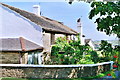
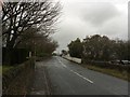
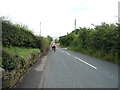
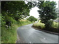
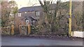
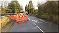
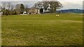
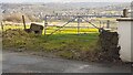
Photos of Ramsgreave
Area Information
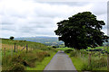
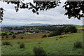
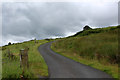
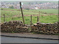
Ramsgreave sits on the northern edge of Blackburn within the Ribble Valley district of Lancashire. This civil parish covers a total area of 3.1 km², making it a compact community where local life revolves around immediate surroundings. The population numbers approximately 1,441 residents, fostering an intimate sense of place where neighbours tend to know one another. Life here moves at a slower pace compared to urban centres, yet digital infrastructure remains robust for those working remotely. Located near the postcode BB1 8QX, the parish offers a rural setting that balances proximity to the town of Blackburn with significant open spaces. The area does not fall under strict planning constraints such as the Area of Outstanding Natural Beauty or Ramsar wetland sites, although it does contain protected woodland. This mixture of open countryside and small-town utility defines the daily experience for anyone considering living in Ramsgreave.
- Area Type
- Parish
- Area Size
- 3.1 km²
- Population
- Not available
- Population Density
- Not available
Demographics
The community in Ramsgreave presents a clear demographic profile shaped by its rural nature. The median age across the parish stands at 70, indicating a population skewed significantly towards older residents. The most common age range reflects this dominance of seniors rather than families or young professionals. Home ownership is the primary property arrangement, with 89 percent of residents owning their homes outright or with a mortgage. This high figure suggests financial stability among the population and a strong preference for staying put as one ages. Household composition and ethnic diversity metrics are present but do not alter the fundamental character of the area, which remains statistically homogeneous in its make-up. With such a high proportion of owner-occupiers, the community likely possesses deep local roots and long-term stability. Anyone looking at homes in Ramsgreave will be entering an established environment where property turnover is slower than in younger, transient townships.
Household Size
Accommodation Type
Tenure
Ethnic Group
Religion
Household Composition
Age
Household Deprivation
NS-SEC
Explore more demographic insights in this area
Go to Demographics tabPlanning
Planning Constraints
- Flood RiskPremium
- Ramsar Wetland SitesPremium
- Area of Outstanding Natural BeautyPremium
- Protected Nature ReservePremium
- Protected WoodlandPremium
- Crime RiskPremium