Area Overview for PR9 9YP
Photos of PR9 9YP


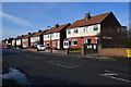


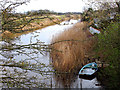
42 photos from this area
Area Information
Key information about the PR9 9YP including its size, population, and administrative classification.
- Area Type
- Postcode
- Area Size
- 5621 m²
- Population
- 1160
- Population Density
- 2906 people/km²
House Prices in PR9 9YP
14
Properties
£146,680
Average Sold Price
£3,960
Lowest Price
£225,000
Highest Price
Showing 14 properties
| Address | Type | Beds | Baths | Last Sale Price | Last Sale Date | |
|---|---|---|---|---|---|---|
| 10 Ferryside Lane, Southport, PR9 9YP | Bungalow | 3 | - | £3,960 | Mar 2024 | |
| 18 Ferryside Lane, Southport, PR9 9YP | Bungalow | - | - | £210,000 | Dec 2021 | |
| 12 Ferryside Lane, Southport, PR9 9YP | Bungalow | - | - | £178,000 | Jun 2021 | |
| 34 Ferryside Lane, Southport, PR9 9YP | Bungalow | 2 | 1 | £197,500 | Oct 2020 | |
| 30 Ferryside Lane, Southport, PR9 9YP | Bungalow | 2 | 1 | £225,000 | Aug 2020 | |
| 36 Ferryside Lane, Southport, PR9 9YP | Bungalow | - | - | £175,000 | Sep 2019 | |
| 22 Ferryside Lane, Southport, PR9 9YP | Semi-detached | 2 | 1 | £157,000 | Aug 2017 | |
| 32 Ferryside Lane, Southport, PR9 9YP | Bungalow | - | - | £157,450 | Dec 2011 | |
| 14 Ferryside Lane, Southport, PR9 9YP | Bungalow | - | - | £150,000 | Sep 2010 | |
| 24 Ferryside Lane, Southport, PR9 9YP | Semi-detached | - | - | £172,250 | May 2005 |
Page 1 of 2
Energy Efficiency in PR9 9YP
Amenities
Schools
| Rank | School | Type | Entry gender | Ages |
|---|
Explore more schools in this area
Go to Schools tabDemographics
Household Size
Two person
most common
Accommodation Type
Houses
most common
Tenure
88
majority
Ethnic Group
White
most common
Religion
N/A
most common
Household Composition
N/A
most common
Age
47
median
Elderly (65+ years)
most common
Household Deprivation
N/A
with no deprivation
NS-SEC
33
in Lower managerial occupations
Explore more demographic insights in this area
Go to Demographics tabPlanning
Planning Constraints
- Flood RiskPremium
- Ramsar Wetland SitesPremium
- Area of Outstanding Natural BeautyPremium
- Protected Nature ReservePremium
- Protected WoodlandPremium