Area Overview for PR9 9XH
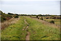
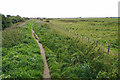
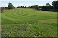
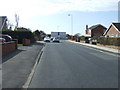
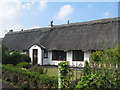
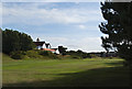
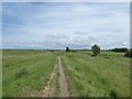
Photos of PR9 9XH

Area Information
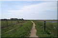
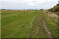
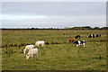
Living in PR9 9XH offers a settled existence within a defined cluster of over 1.2 hectares. This small residential postcode contains a population of 1,389 people, creating a neighbourhood that remains intimate despite its proximity to larger towns. The area sits in England with a high population density of 1,362 people per square kilometre, meaning streets are populated but not crowded. Daily life here revolves around close proximity to neighbours and established local routines. You will find a community where residents know each other, supported by a compact footprint that limits the need for long commutes to nearby services. The environment is characterised by residential housing rather than industrial or large-scale commercial development. You can rely on a consistent local character where the focus remains on family life and home ownership. This specific postcode is not a sprawling suburb but a concentrated residential zone where every street has a clear purpose for existing households.
- Area Type
- Postcode
- Area Size
- 1.2 hectares
- Population
- 1389
- Population Density
- 1362 people/km²
The property market in PR9 9XH is defined by a static and reliable stock of houses with 87% of residents being home owners. This high ownership percentage indicates that the local economy supports significant investment in property and maintenance. You will find a market where sellers are likely to be long-term residents rather than landlords seeking quick returns. The accommodation type is strictly houses, so you cannot find flats or shared accommodation listings within this postcode boundary. This makes the area an excellent choice for families seeking a private garden and traditional living arrangements. Buyers looking here should expect a market driven by local knowledge and history of the street rather than speculative development. The small area size of 1.2 hectares limits new builds, ensuring that the housing stock remains established. Competition is healthy among those wishing to move within this specific residential cluster, reflecting the demand for this type of owned property in the region.
House Prices in PR9 9XH
Showing 8 properties
| Address | Type | Beds | Baths | Last Sale Price | Last Sale Date | |
|---|---|---|---|---|---|---|
| 5 Fylde Road, Southport, PR9 9XH | Bungalow | - | - | £225,000 | Jul 2021 | |
| 11 Fylde Road, Southport, PR9 9XH | house | - | - | £152,000 | Oct 2014 | |
| 7 Fylde Road, Southport, PR9 9XH | house | - | - | £142,500 | Jun 2010 | |
| 9 Fylde Road, Southport, PR9 9XH | Semi-detached | - | - | £180,000 | Jan 2008 | |
| 15 Fylde Road, Southport, PR9 9XH | Semi-detached | 4 | 2 | - | - | |
| 1 Fylde Road, Southport, PR9 9XH | Detached | - | - | - | - | |
| 3 Fylde Road, Southport, PR9 9XH | Bungalow | - | - | - | - | |
| Premises Adjacent 15, Fylde Road, Southport, PR9 9XH | Semi-detached | - | - | - | - |
Energy Efficiency in PR9 9XH
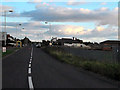
Your everyday lifestyle in PR9 9XH benefits from a practical range of amenities within practical reach. For retail needs, you can access Morrisons Daily, Co-op Fylde, and Spar, providing three distinct options for groceries and convenience shopping. This variety means you do not have to travel far to find basic supplies or household necessities. For travel, five railway stations serve the region, including Meols Cop Railway Station, Southport Railway Station, and Birkdale Railway Station. These notable stations offer you the flexibility to commute or take day trips without owning a car. The presence of both local shops and regional rail links creates a balanced lifestyle. You can enjoy the quiet of residential life while knowing that broader facilities are easily accessible. The mix of specific retailers and transport hubs ensures that daily logistics run smoothly for everyone living here.
Amenities
Schools
Families living in PR9 9XH have access to Marshside Primary School, which is situated nearby. This institution operates as a primary school and holds a Good Ofsted rating. The presence of a single named primary school suggests that educational provision is focused and specialised for younger children in this cluster. This rating confirms that the school meets high standards of education and behaviour management. For parents, this means their children can attend an inspected and approved facility without travelling far from the house. The absence of secondary schools in the immediate data suggests that older pupils may travel to larger towns for further education. The Good rating at Marshside Primary School provides a solid foundation for early education. You can rely on this specific school name when discussing local schooling options for children in this postcode.
| Rank | School | Type | Entry gender | Ages |
|---|
Explore more schools in this area
Go to Schools tabDemographics
The community in PR9 9XH is dominated by adults, with the median age standing at 47 years. Most residents fall into the 30 to 64 year age bracket, indicating a demographic focused on stability and family life. Home ownership is the norm here, with 87% of households owning their property outright or with a mortgage. This high figure suggests strong roots in the area and a preference for long-term living over rental arrangements. The accommodation type is exclusively houses, meaning you will not find flats or apartments within this specific cluster. The predominant ethnic group is White, reflecting the established nature of the settlement. This demographic profile points to a neighbourhood where families have settled for generations. The high ownership rate and adult population mean that the area is less likely to experience the rapid turnover of short-term tenants compared to urban city centres. Children are present, supported by the high number of owner-occupiers who typically raise families in houses.
Household Size
Accommodation Type
Tenure
Ethnic Group
Religion
Household Composition
Age
Household Deprivation
NS-SEC
Explore more demographic insights in this area
Go to Demographics tabPlanning
Planning Constraints
- Flood RiskPremium
- Ramsar Wetland SitesPremium
- Area of Outstanding Natural BeautyPremium
- Protected Nature ReservePremium
- Protected WoodlandPremium