Area Overview for PR9 9WF
Photos of PR9 9WF


Area Information
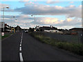
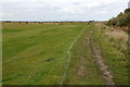
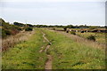
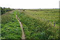
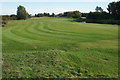
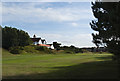
PR9 9WF is a small postcode area situated within the broader region of England. The location covers a specific residential cluster with a population of 1372 people. This compact community offers a defined sense of place for those seeking a settled environment. You will find a high degree of stability here, characterised by a predominantly owner-occupied stock and a lack of major planning constraints. The area sits clear of protected landscapes such as Areas of Outstanding Natural Beauty or Ramsar wetland sites, which means local development is guided by standard planning regulations. Daily life revolves around the convenience of nearby rail links to towns like Meols Cop, Southport, and Birkdale. You have practical access to essential retail needs, including stores such as Morrisons Daily, Co-op Fylde, and Spar. Living in PR9 9WF means settling into a neighbourhood where the majority of residents are established homeowners rather than tenants. The demographic profile suggests a community anchored largely by adults in their prime working or retirement years. There are no vague descriptors or inflated claims to navigate; the facts present a clear picture of a functional, residential corner of the Fylde peninsula suited for those who prioritise stability and community cohesion.
- Area Type
- Postcode
- Area Size
- Not available
- Population
- 1372
- Population Density
- 3897 people/km²
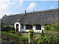
The property market in PR9 9WF is overwhelmingly characterised by owner-occupancy. With 91% of homes held by their owners, the area is distinct from high-density rental hubs found in many urban centres. The accommodation type data confirms that houses are the predominant housing stock, not flats or maisonettes. This housing mixture shapes the buyer's experience significantly. You are entering a market where established families or retirees have already secured their homes. This stability often translates into a slower, more deliberative market where properties stay on the market once buyers find the right match. For a prospective buyer, this means competition may come from local residents looking to trade up rather than from transient investors flipping homes for quick profit. The type of accommodation available is limited to houses, which aligns with the area's residential profile. When viewing homes in this postcode, you will not encounter the variety of short-let styles or multi-generational flat complexes found elsewhere. The market reflects the demographic reality of the zone. If you seek a traditional house in a low-density environment, PR9 9WF presents that specific profile. The 91% ownership rate is a concrete indicator that this is a bought market, not a rented one.
House Prices in PR9 9WF
No properties found in this postcode.
Energy Efficiency in PR9 9WF
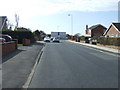
Your daily lifestyle in PR9 9WF centres on convenience. Retail options are within practical reach, with five nearby stores identified. Notable venues include Morrisons Daily, Co-op Fylde, and Spar. These specific supermarkets and convenience stores mean you are not reliant on village shops that may have limited hours. You can perform most grocery and daily shopping needs without extensive travel. Transport links further enhance this lifestyle, with five rail stations accessible nearby. Meols Cop Railway Station, Southport Railway Station, and Birkdale Railway Station are the key hubs connecting you to broader destinations. The proximity of these transport nodes means you can commute or travel for leisure with a degree of ease. The area lacks the grand amenities of a major city but delivers the essentials efficiently. You will find yourself within a short drive or walk of these facilities. The character of the lifestyle is one of practical independence. You have the retail infrastructure for daily needs and the rail infrastructure for longer journeys. This balance allows you to enjoy the quiet of the postcode while maintaining full access to the services of the surrounding towns.
Amenities
Schools
Families living in or near PR9 9WF have access to a specific mix of educational institutions. St Patrick's Catholic Primary School is the named establishment within the immediate vicinity of this postcode. This is a primary school with an Ofsted rating of good. The presence of a good-rated primary school is a central feature of the local education landscape for this demographic. While the dataset does not list secondary schools, the availability of a well-regarded local primary facility is a key selling point for families with young children. The school type is specific, offering a religious education environment under the Catholic designation. This single entry in the data suggests that the primary catchment for this small cluster relies heavily on this one institution. For parents considering schools near PR9 9WF, the reliability of St Patrick's is the primary documented option. You do not have a choice between numerous primaries in this immediate area; the provision is focused. This concentration of provision means the school has a defined local role. The 'good' rating provides a factual basis for confidence in the education quality available to children residing in this postcode.
| Rank | School | Type | Entry gender | Ages |
|---|
Explore more schools in this area
Go to Schools tabDemographics
The community in PR9 9WF is defined by a stable adult population. The median age sits at 47 years, and the most common age range includes adults from 30 to 64 years old. This indicates that the area is less focused on young families moving in for the first time or elderly residents requiring specific care facilities. Instead, it accommodates households in their middle years who are likely raising children or caring for aging parents. Consistent with this demographic stability, home ownership stands at 91%. This high figure suggests a long-term settlement pattern where residents intend to stay for the duration. The predominant form of accommodation consists of houses, reinforcing the suburban or semi-rural character of the postcode. Diversity is reflected in a White population, which forms the majority group within the area. While the area lacks the statistical marker for deprivation in this dataset, the high ownership rate and older demographic usually correlate with established wealth and fewer blight issues common in younger rental markets. You are looking at a neighbourhood where the social fabric is woven by people who have roots in the area. The absence of rental dominance means you are less likely to negotiate with a let agent and more likely to interact with your neighbours as fellow residents of the same street.
Household Size
Accommodation Type
Tenure
Ethnic Group
Religion
Household Composition
Age
Household Deprivation
NS-SEC
Explore more demographic insights in this area
Go to Demographics tabPlanning
Planning Constraints
- Flood RiskPremium
- Ramsar Wetland SitesPremium
- Area of Outstanding Natural BeautyPremium
- Protected Nature ReservePremium
- Protected WoodlandPremium