Area Overview for PR9 9TY
Photos of PR9 9TY
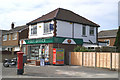
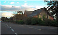
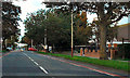
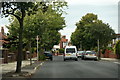
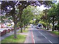

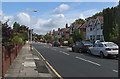
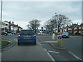
16 photos from this area
Area Information
Key information about the PR9 9TY including its size, population, and administrative classification.
- Area Type
- Postcode
- Area Size
- 9222 m²
- Population
- 1361
- Population Density
- 4721 people/km²
House Prices in PR9 9TY
31
Properties
£130,819
Average Sold Price
£30,000
Lowest Price
£235,000
Highest Price
Showing 31 properties
| Address | Type | Beds | Baths | Last Sale Price | Last Sale Date | |
|---|---|---|---|---|---|---|
| 12 Lytham Road, Southport, PR9 9TY | Semi-detached | 2 | 1 | £190,000 | Aug 2025 | |
| 22 Lytham Road, Southport, PR9 9TY | house | - | - | £180,000 | Aug 2025 | |
| 58 Lytham Road, Southport, PR9 9TY | Semi-detached | 4 | 1 | £235,000 | Mar 2025 | |
| 46 Lytham Road, Southport, PR9 9TY | Semi-detached | 2 | 1 | £150,000 | Mar 2024 | |
| 2 Lytham Road, Southport, PR9 9TY | house | 2 | - | £105,000 | Aug 2023 | |
| 56 Lytham Road, Southport, PR9 9TY | house | - | - | £140,000 | Apr 2022 | |
| 8 Lytham Road, Southport, PR9 9TY | house | - | - | £176,000 | Mar 2022 | |
| 54 Lytham Road, Southport, PR9 9TY | Semi-detached | 2 | 1 | £162,500 | Feb 2022 | |
| 42 Lytham Road, Southport, PR9 9TY | house | - | - | £140,000 | May 2021 | |
| 20 Lytham Road, Southport, PR9 9TY | house | - | - | £147,500 | Mar 2021 |
Page 1 of 4
Energy Efficiency in PR9 9TY
Amenities
Schools
| Rank | School | Type | Entry gender | Ages |
|---|
Explore more schools in this area
Go to Schools tabDemographics
Household Size
Two person
most common
Accommodation Type
Houses
most common
Tenure
87
majority
Ethnic Group
White
most common
Religion
N/A
most common
Household Composition
N/A
most common
Age
47
median
Adults (30-64 years)
most common
Household Deprivation
N/A
with no deprivation
NS-SEC
31
in Lower managerial occupations
Explore more demographic insights in this area
Go to Demographics tabPlanning
Planning Constraints
- Flood RiskPremium
- Ramsar Wetland SitesPremium
- Area of Outstanding Natural BeautyPremium
- Protected Nature ReservePremium
- Protected WoodlandPremium