Area Overview for PR9 9RU
Photos of PR9 9RU
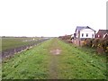
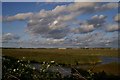
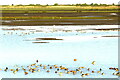
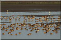
21 photos from this area
Area Information
Key information about the PR9 9RU including its size, population, and administrative classification.
- Area Type
- Postcode
- Area Size
- 5099 m²
- Population
- 1165
- Population Density
- 338 people/km²
House Prices in PR9 9RU
14
Properties
£116,743
Average Sold Price
£48,995
Lowest Price
£174,999
Highest Price
Showing 14 properties
| Address | Type | Beds | Baths | Last Sale Price | Last Sale Date | |
|---|---|---|---|---|---|---|
| 40 Truro Avenue, Southport, PR9 9RU | house | - | - | £174,999 | Sep 2019 | |
| 32 Truro Avenue, Southport, PR9 9RU | Semi-detached | 3 | 1 | £130,000 | Mar 2016 | |
| 30 Truro Avenue, Southport, PR9 9RU | Semi-detached | - | - | £159,950 | Jul 2011 | |
| 22 Truro Avenue, Southport, PR9 9RU | house | - | - | £127,000 | Dec 2003 | |
| 42 Truro Avenue, Southport, PR9 9RU | Detached | - | - | £122,000 | Jan 2002 | |
| 38 Truro Avenue, Southport, PR9 9RU | Semi-detached | - | - | £48,995 | Feb 2000 | |
| 35 Truro Avenue, Southport, PR9 9RU | Detached | - | - | £117,000 | Jul 1999 | |
| 28 Truro Avenue, Southport, PR9 9RU | Semi-detached | - | - | £54,000 | Jun 1997 | |
| 18 Truro Avenue, Southport, PR9 9RU | Semi-detached | - | - | - | - | |
| 34 Truro Avenue, Southport, PR9 9RU | Terraced | - | - | - | - |
Page 1 of 2
Energy Efficiency in PR9 9RU
Amenities
Schools
| Rank | School | Type | Entry gender | Ages |
|---|
Explore more schools in this area
Go to Schools tabDemographics
Household Size
Two person
most common
Accommodation Type
Houses
most common
Tenure
89
majority
Ethnic Group
White
most common
Religion
N/A
most common
Household Composition
N/A
most common
Age
47
median
Adults (30-64 years)
most common
Household Deprivation
N/A
with no deprivation
NS-SEC
32
in Lower managerial occupations
Explore more demographic insights in this area
Go to Demographics tabPlanning
Planning Constraints
- Flood RiskPremium
- Ramsar Wetland SitesPremium
- Area of Outstanding Natural BeautyPremium
- Protected Nature ReservePremium
- Protected WoodlandPremium