Area Overview for PR9 9ND
Photos of PR9 9ND

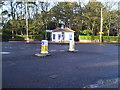
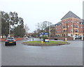
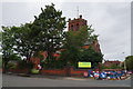
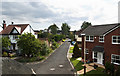

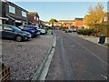

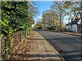

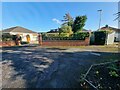
33 photos from this area
Area Information
Key information about the PR9 9ND including its size, population, and administrative classification.
- Area Type
- Postcode
- Area Size
- 1.3 hectares
- Population
- 1545
- Population Density
- 3215 people/km²
House Prices in PR9 9ND
23
Properties
£177,812
Average Sold Price
£57,000
Lowest Price
£410,000
Highest Price
Showing 23 properties
| Address | Type | Beds | Baths | Last Sale Price | Last Sale Date | |
|---|---|---|---|---|---|---|
| 6, Croxton Court, Park Crescent, Southport, PR9 9ND | Flat | 2 | 1 | £155,000 | Mar 2025 | |
| 1, Croxton Court, Park Crescent, Southport, PR9 9ND | Flat | 2 | 1 | £178,000 | Jan 2025 | |
| 7, Croxton Court, Park Crescent, Southport, PR9 9ND | Flat | - | - | £167,000 | Mar 2024 | |
| 3, Croxton Court, Park Crescent, Southport, PR9 9ND | Flat | - | - | £155,000 | Dec 2023 | |
| 2, Croxton Court, Park Crescent, Southport, PR9 9ND | Flat | - | - | £170,000 | Nov 2023 | |
| 5, Croxton Court, Park Crescent, Southport, PR9 9ND | Flat | 2 | 1 | £117,500 | Sep 2021 | |
| 14, Croxton Court, Park Crescent, Southport, PR9 9ND | Flat | - | - | £120,000 | Jul 2020 | |
| 11, Croxton Court, Park Crescent, Southport, PR9 9ND | Flat | - | - | £145,000 | Jun 2019 | |
| 23 Park Crescent, Southport, PR9 9ND | Detached | 3 | 1 | £280,000 | Jun 2018 | |
| 9, Croxton Court, Park Crescent, Southport, PR9 9ND | Flat | - | - | £99,500 | Mar 2017 |
Page 1 of 3
Energy Efficiency in PR9 9ND
Amenities
Schools
| Rank | School | Type | Entry gender | Ages |
|---|
Explore more schools in this area
Go to Schools tabDemographics
Household Size
One person
most common
Accommodation Type
Flats
most common
Tenure
69
majority
Ethnic Group
White
most common
Religion
N/A
most common
Household Composition
N/A
most common
Age
47
median
Elderly (65+ years)
most common
Household Deprivation
N/A
with no deprivation
NS-SEC
38
in Lower managerial occupations
Explore more demographic insights in this area
Go to Demographics tabPlanning
Planning Constraints
- Flood RiskPremium
- Ramsar Wetland SitesPremium
- Area of Outstanding Natural BeautyPremium
- Protected Nature ReservePremium
- Protected WoodlandPremium