Area Overview for PR9 9EF
Photos of PR9 9EF
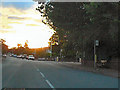
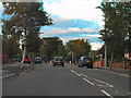
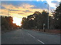
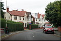
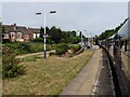
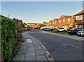
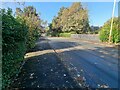
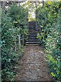
34 photos from this area
Area Information
Key information about the PR9 9EF including its size, population, and administrative classification.
- Area Type
- Postcode
- Area Size
- 2.3 hectares
- Population
- 1545
- Population Density
- 3215 people/km²
House Prices in PR9 9EF
52
Properties
£291,991
Average Sold Price
£120,000
Lowest Price
£475,000
Highest Price
Showing 52 properties
| Address | Type | Beds | Baths | Last Sale Price | Last Sale Date | |
|---|---|---|---|---|---|---|
| 37A Park Avenue, Southport, PR9 9EF | Detached | 4 | 1 | £475,000 | Aug 2023 | |
| 41 Park Avenue, Southport, PR9 9EF | Retail | 3 | 2 | £385,000 | Aug 2022 | |
| 26 Park Avenue, Southport, PR9 9EF | Detached | 4 | 2 | £437,000 | Sep 2021 | |
| 28 Park Avenue, Southport, PR9 9EF | Detached | 4 | 2 | £359,950 | Jun 2020 | |
| 43 Park Avenue, Southport, PR9 9EF | Detached | 3 | 2 | £286,000 | Mar 2018 | |
| 36A Park Avenue, Southport, PR9 9EF | house | 3 | - | £185,000 | Jul 2010 | |
| 39A Park Avenue, Southport, PR9 9EF | Bungalow | - | - | £250,000 | Jan 2009 | |
| 30 Park Avenue, Southport, PR9 9EF | Detached | 4 | - | £389,950 | May 2005 | |
| 37 Park Avenue, Southport, PR9 9EF | Detached | - | - | £149,000 | Mar 2001 | |
| 29 Park Avenue, Southport, PR9 9EF | Detached | - | - | £175,000 | Jul 1999 |
Page 1 of 6
Energy Efficiency in PR9 9EF
Amenities
Schools
| Rank | School | Type | Entry gender | Ages |
|---|
Explore more schools in this area
Go to Schools tabDemographics
Household Size
One person
most common
Accommodation Type
Flats
most common
Tenure
69
majority
Ethnic Group
White
most common
Religion
N/A
most common
Household Composition
N/A
most common
Age
47
median
Elderly (65+ years)
most common
Household Deprivation
N/A
with no deprivation
NS-SEC
38
in Lower managerial occupations
Explore more demographic insights in this area
Go to Demographics tabPlanning
Planning Constraints
- Flood RiskPremium
- Ramsar Wetland SitesPremium
- Area of Outstanding Natural BeautyPremium
- Protected Nature ReservePremium
- Protected WoodlandPremium