Area Overview for PR9 9DS
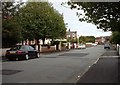
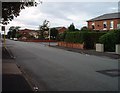
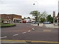
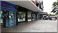
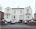
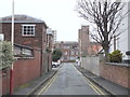
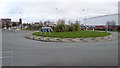
Photos of PR9 9DS


Area Information
Living in PR9 9DS offers a specific residential experience within the wider Merseyside context. This postcode covers a small cluster containing 1,545 people, creating an intimate neighbourhood rather than a sprawling district. You are looking at a place where daily life revolves around local connections and established routines. The area functions as a tight-knit community where residents know their immediate surroundings well. Families and individuals seeking a quiet corner away from the busiest urban centres will find this scale appealing because it limits through traffic and noise. The residential nature of the cluster means your morning commute involves navigating established streets rather than developing construction sites. The character of PR9 9DS is defined by its status as a defined residential zone. You will not find large commercial developments or industrial estates dominating the street fronts. Instead, the landscape is focused on housing and local access points. This setting suits those who prioritise a settled environment over rapid expansion. The population size suggests that community events and local governance operate on a manageable scale. When you walk or cycle around the area, you create meaningful interactions with neighbours. This is not a place designed for high-density living but for those who value a defined territory. The boundaries of the postcode ensure that services and planning decisions affect a limited group of people directly.
- Area Type
- Postcode
- Area Size
- Not available
- Population
- 1545
- Population Density
- 3215 people/km²
The property market in PR9 9DS is characterised by stable tenure and specific accommodation types. You will find that 69% of residents own their homes, creating a market driven by those with established equity in their properties. This high percentage of owner-occupiers suggests a district where people have made lasting commitments to their addresses. Consequently, you should expect strong attachment to properties and regular maintenance from residents. The accommodation stock is dominated by flats, which are central to the living arrangements in this postcode cluster. These flats accommodate the majority of the 1,545 people who call PR9 9DS home. For buyers entering this market, the flat-heavy stock means you are looking at shared buildings or purpose-built blocks rather than detached houses or semi-detached pairs. This configuration often appeals to those seeking low-maintenance living without the space of a traditional house. The prevalence of ownership also indicates that the area may sell slower than rental-heavy zones, as owners often wait for the right buyer who appreciates the specific character of their home. When you browse listings for homes in PR9 9DS, you are engaging with a seller base that values long-term ownership. The market dynamics reflect a low-transaction volume but high-stakes environment where price per square metre in a flat often holds steady due to local demand. You are entering a market that rewards patience and specific buyer criteria.
House Prices in PR9 9DS
No properties found in this postcode.
Energy Efficiency in PR9 9DS
Your daily life in PR9 9DS is supported by a cluster of retail and transport amenities within easy reach. You have access to five retail outlets, including Spar, Morrisons Daily Southport 83, and Tesco Hesketh. These shops provide your essential groceries and household necessities without requiring a journey to the city centre. Planning your week around these stores means you can collect fresh food on your way home from the rail station. Railway connectivity is strong, with five stations serving the wider vicinity. Meols Cop Railway Station, Southport Railway Station, and Birkdale Railway Station facilitate travel to and from larger towns. You can reach these hubs quickly, integrating the area into a broader regional network. Convenience is a key feature of living here. With five retail options nearby, rare trips for basics are eliminated from your routine. The presence of these specific stores indicates a well-supported commercial perimeter for the residents. If you prefer walking to your shops, the proximity to Spar and Tesco Hesketh makes short trips efficient. The area also provides access to one airport location, RAF Woodvale, although this serves a mixed function for the local community. This concentration of services means you do not need a vehicle for every task if you utilise the rail links for longer journeys. The lifestyle here is one of practical accessibility, where everyday needs are met without excessive travel time.
Amenities
Schools
| Rank | School | Type | Entry gender | Ages |
|---|
Explore more schools in this area
Go to Schools tabDemographics
The community in PR9 9DS reflects a mature demographic profile with distinct housing tenure patterns. Your potential neighbours are primarily White, forming the predominant ethnic group within this small postcode. You will find that the average resident is 47 years old, indicating a population that has settled in the area for a significant period. The most common age range is those aged 65 and over, suggesting a neighbourhood where many retirees have established long-term roots. This age composition often correlates with a slower pace of life and a focus on community stability rather than rapid change. Home ownership stands at an impressive 69%, which shapes the social fabric significantly. Most households have purchased their homes, meaning the area is dominated by owner-occupiers rather than landlords or short-term tenants. This high level of residence ownership typically fosters stronger civic engagement and property upkeep. Accommodation types in PR9 9DS are primarily flats, which aligns with the higher density often found in established urban clusters. These flats provide efficient living spaces for the resident population. With 1,545 people spread across this stock, you can expect a settled environment where long-term relationships between neighbours are common. The demographics suggest a predictable lifestyle where major shifts in population structure are unlikely in the near future.
Household Size
Accommodation Type
Tenure
Ethnic Group
Religion
Household Composition
Age
Household Deprivation
NS-SEC
Explore more demographic insights in this area
Go to Demographics tabPlanning
Planning Constraints
- Flood RiskPremium
- Ramsar Wetland SitesPremium
- Area of Outstanding Natural BeautyPremium
- Protected Nature ReservePremium
- Protected WoodlandPremium