Area Overview for PR9 9DP
Photos of PR9 9DP
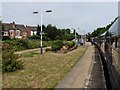
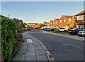
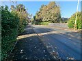
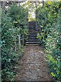

34 photos from this area
Area Information
Key information about the PR9 9DP including its size, population, and administrative classification.
- Area Type
- Postcode
- Area Size
- 4512 m²
- Population
- 1545
- Population Density
- 3215 people/km²
House Prices in PR9 9DP
8
Properties
£195,817
Average Sold Price
£130,000
Lowest Price
£235,000
Highest Price
Showing 8 properties
| Address | Type | Beds | Baths | Last Sale Price | Last Sale Date | |
|---|---|---|---|---|---|---|
| 2, Roe Park Mews, Roe Lane, Southport, PR9 9DP | house | - | - | £229,500 | Aug 2021 | |
| 6, Roe Park Mews, Roe Lane, Southport, PR9 9DP | house | 3 | - | £235,000 | Dec 2014 | |
| 7, Roe Park Mews, Roe Lane, Southport, PR9 9DP | house | 3 | - | £220,000 | Nov 2013 | |
| 3, Roe Park Mews, Roe Lane, Southport, PR9 9DP | Terraced | - | - | £218,400 | Aug 2004 | |
| 4, Roe Park Mews, Roe Lane, Southport, PR9 9DP | Semi-detached | - | - | £142,000 | Jul 2002 | |
| 8, Roe Park Mews, Roe Lane, Southport, PR9 9DP | Flat | - | - | £130,000 | Aug 2001 | |
| 5, Roe Park Mews, Roe Lane, Southport, PR9 9DP | Detached | 3 | 1 | - | - | |
| 1, Roe Park Mews, Roe Lane, Southport, PR9 9DP | Terraced | - | - | - | - |
Energy Efficiency in PR9 9DP
Amenities
Schools
| Rank | School | Type | Entry gender | Ages |
|---|
Explore more schools in this area
Go to Schools tabDemographics
Household Size
One person
most common
Accommodation Type
Flats
most common
Tenure
69
majority
Ethnic Group
White
most common
Religion
N/A
most common
Household Composition
N/A
most common
Age
47
median
Elderly (65+ years)
most common
Household Deprivation
N/A
with no deprivation
NS-SEC
38
in Lower managerial occupations
Explore more demographic insights in this area
Go to Demographics tabPlanning
Planning Constraints
- Flood RiskPremium
- Ramsar Wetland SitesPremium
- Area of Outstanding Natural BeautyPremium
- Protected Nature ReservePremium
- Protected WoodlandPremium