Area Overview for PR9 8PU
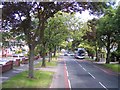
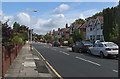
Photos of PR9 8PU


Area Information
PR9 8PU represents a tightly defined residential cluster within England, covering exactly 3,484 square metres. You can expect to find 1,361 people residing within this specific postcode boundary. The area functions as a small neighbourhood unit where daily life revolves around a compact community environment. This density creates a neighbourhood where residents know one another, yet the specific spatial limits mean every foot of land is utilised for housing or essential access paths. The character here is shaped by the fact that this postcode is not a sprawling district but a precise geographical point. Living in PR9 8PU means being part of a defined pocket where the size of the area dictates the pace of life. You will find the typical mix of suburban quiet found in similar postcode zones, yet the exact boundaries ensure a focused local identity. The population density suggests a settled community where residents have established roots. There is no room for sprawl within these limits, which often leads to a tight-knit social fabric. Prospective buyers looking at PR9 8PU are entering a space where the built environment and population coexist within a rigid framework. The area offers a concentrated slice of family home living, removing the vast distances found in larger districts. This specificity defines the lifestyle, ensuring that convenience and locality are the primary drivers of daily routine. The area serves as a stable residential enclave rather than a commercial hub or a transit corridor.
- Area Type
- Postcode
- Area Size
- 3484 m²
- Population
- 1361
- Population Density
- 4721 people/km²
The housing stock in PR9 8PU is almost entirely comprised of Houses, reflecting a dedicated market for single-family dwellings. With 87% of residents being homeowners, the area functions as a strong owner-occupied zone rather than a rental hub. This high ownership rate suggests that buyers here are primarily looking to put down roots and stay long-term. The accommodation type data confirms you will find houses, meaning the architecture and street life cater to suburban family living. There are no flats or apartments recorded within this specific postcode, which limits options for those seeking smaller, multi-unit properties. The property market is stabilised by the fact that the majority of households have purchased their homes. This creates a community where property values are influenced by factors that sustain long-term investment. Buyers looking at PR9 8PU should expect a traditional house market. The lack of rental inventory signals that the immediate surroundings are not flooded with transient tenants. This stability often protects against rapid market fluctuations. The market reflects a settled pattern where families have found homes that suit their needs for private living. The 87% ownership figure is a direct testament to this preference. Potential buyers must appreciate that competition will likely come from other families seeking similar house-based environments. The area does not cater to investors looking for high-turnover rental yields. Instead, it appeals to those seeking a solid, private home. The concentration of houses defines the streetscape and the type of gardens one can expect to maintain. This is clearly a zone for established homeowners.
House Prices in PR9 8PU
Showing 14 properties
| Address | Type | Beds | Baths | Last Sale Price | Last Sale Date | |
|---|---|---|---|---|---|---|
| 6, Larkfield Court, 1A Larkfield Lane, Southport, PR9 8PU | Flat | 2 | 1 | £148,000 | Feb 2025 | |
| 11, Larkfield Court, 1A Larkfield Lane, Southport, PR9 8PU | Flat | 2 | 1 | £135,000 | Oct 2023 | |
| 5, Larkfield Court, 1A Larkfield Lane, Southport, PR9 8PU | Flat | - | - | £145,000 | May 2023 | |
| 2, Larkfield Court, 1A Larkfield Lane, Southport, PR9 8PU | Flat | 2 | 1 | £135,000 | Sep 2022 | |
| 1, Larkfield Court, 1A Larkfield Lane, Southport, PR9 8PU | Flat | - | - | £9,850 | May 2021 | |
| 12, Larkfield Court, 1A Larkfield Lane, Southport, PR9 8PU | Flat | - | - | £114,000 | Jan 2020 | |
| 3, Larkfield Court, 1A Larkfield Lane, Southport, PR9 8PU | Flat | - | - | £127,000 | Jan 2019 | |
| 13, Larkfield Court, 1A Larkfield Lane, Southport, PR9 8PU | Flat | - | - | £100,000 | Nov 2013 | |
| 4, Larkfield Court, 1A Larkfield Lane, Southport, PR9 8PU | Flat | - | - | £100,000 | Oct 2013 | |
| 8, Larkfield Court, 1A Larkfield Lane, Southport, PR9 8PU | Flat | - | - | £70,250 | Jun 2002 |
Energy Efficiency in PR9 8PU
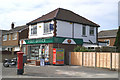
Your daily life in PR9 8PU is supported by practical amenities within easy reach. There are five retail locations nearby, including Morrisons Daily, Spar, and Tesco Churchtown. These stores provide essential shopping needs without requiring a long journey. You can access groceries and daily necessities from one of these three main names. Five railway stations also serve the wider area, offering connections at Meols Cop, Southport, and Birkdale. These rail links give you options for commuting or weekend trips beyond the local zone. The presence of multiple stations means you are not isolated from the broader transport network. Living in PR9 8PU grants you direct access to these five retail and five rail points. The shops offer convenience, reducing the need to travel far for basics. The rail network ensures you can reach larger city centres if required. This combination of retail and transport creates a balanced lifestyle. You have the luxury of local shopping combined with national connectivity. The variety of stations at Meols Cop, Southport, and Birkdale provides flexibility in your travel choices. Shops like Tesco and Morrisons form the commercial heart of your daily routine. The area is defined by these practical assets rather than grand attractions. Daily life relies on this straightforward access to goods and travel.
Amenities
Schools
| Rank | School | Type | Entry gender | Ages |
|---|
Explore more schools in this area
Go to Schools tabDemographics
You enter a demographic profile defined by stability, with 87% of local residents being homeowners. The community is predominantly adult, with the most common age range falling between 30 and 64 years. This age group forms the core of the neighbourhood, suggesting families and established households form the backbone of society here. The median age is exactly 47 years, indicating a mature population with significant local roots. About 87% household ownership confirms that long-term residents own their properties rather than renting. The accommodation type is exclusively Houses, meaning you will not find flats or apartments in this specific postcode cluster. The demographic makeup is chiefly White, reflecting a homogeneous community structure. The high proportion of adults in middle age suggests a stable environment where children and young people may be less dominant in the daily rhythm. This age profile often correlates with a desire for reliable neighbourhoods. The lack of rental properties hints at a market driven by those who have settled permanently. With a population of 1,361 concentrated in such a small footprint, the social interactions are likely frequent and familiar. The community does not rely on transient populations. Instead, it thrives on a static population base where families have stayed for decades. The home ownership rate of 87% stands out as a key indicator of economic stability within the group.
Household Size
Accommodation Type
Tenure
Ethnic Group
Religion
Household Composition
Age
Household Deprivation
NS-SEC
Explore more demographic insights in this area
Go to Demographics tabPlanning
Planning Constraints
- Flood RiskPremium
- Ramsar Wetland SitesPremium
- Area of Outstanding Natural BeautyPremium
- Protected Nature ReservePremium
- Protected WoodlandPremium