Area Overview for PR9 8LE
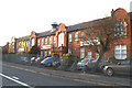
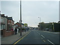
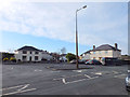
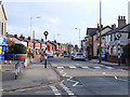
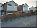
Photos of PR9 8LE


Area Information
Living in PR9 8LE means residing within a compact residential cluster covering just 9,564 square metres in the heart of England. This specific postcode area houses a population of 1,553 people, creating a tight-knit neighbourhood where residents interact frequently. Despite its small physical footprint, the area supports a community with high ground occupancy, reflecting a dense settlement pattern typical of established residential zones. The character of PR9 8LE is defined by its proximity to key towns and settlements, positioning it as a convenient base for commuters seeking shelter from the elements without sacrificing access to local services. You live in an environment where every street corner is within a short walk of your neighbours. This density fosters a sense of community, but it also means noise levels can vary depending on the time of day. The area functions as a practical hub for those who value closeness over sprawling distance. Your daily routine here involves short trips to local amenities and immediate access to transport links. The small size of the cluster ensures that you are never far from essential facilities. Living in this postcode offers a grounded experience of suburban life, away from the isolation of rural districts yet distinct from the metropolitan rush.
- Area Type
- Postcode
- Area Size
- 9564 m²
- Population
- 1553
- Population Density
- 4087 people/km²
The property market in PR9 8LE is almost exclusively owner-occupied, with 74% of residents owning their homes outright or with a mortgage. This statistic clearly indicates that the area is not a rental hub but a place where families and individuals settle down for the long term. The housing stock consists primarily of houses, meaning you will find traditional detached or semi-detached properties rather than multi-storey apartments or flat conversions. This dominance of houses shapes the visual architecture of PR9 8LE, presenting a consistent streetscape of single-family dwellings. Buyers looking at homes in PR9 8LE should expect a market driven by owners selling to other owners, which often results in fewer turnover events compared to high-rental-density zones. The small size of the postcode, covering only 9,564 square metres, limits the volume of properties available, making each individual home significant. Investors seeking high-volume rental yields will not find this location suitable, as the market structure does not support large-scale tenancy. Instead, the market rewards those seeking a secure, owner-occupied future. If you are purchasing a home or looking to upgrade, the scarcity of units adds a layer of exclusivity to the buying process.
House Prices in PR9 8LE
Showing 28 properties
| Address | Type | Beds | Baths | Last Sale Price | Last Sale Date | |
|---|---|---|---|---|---|---|
| 71 Rufford Road, Southport, PR9 8LE | Semi-detached | 3 | 1 | £154,000 | Jun 2023 | |
| 27 Rufford Road, Southport, PR9 8LE | Detached | 3 | 2 | £230,000 | Dec 2022 | |
| 57 Rufford Road, Southport, PR9 8LE | house | - | - | £139,000 | Nov 2021 | |
| 47 Rufford Road, Southport, PR9 8LE | Semi-detached | 2 | 1 | £90,000 | Oct 2019 | |
| 59 Rufford Road, Southport, PR9 8LE | Semi-detached | 4 | - | £148,000 | Sep 2013 | |
| 55 Rufford Road, Southport, PR9 8LE | house | - | - | £134,150 | Mar 2007 | |
| 43 Rufford Road, Southport, PR9 8LE | Semi-detached | - | - | £122,500 | May 2006 | |
| 51 Rufford Road, Southport, PR9 8LE | house | - | - | £119,000 | Mar 2006 | |
| 73 Rufford Road, Southport, PR9 8LE | house | - | - | £112,500 | Nov 2005 | |
| 29 Rufford Road, Southport, PR9 8LE | Detached | 4 | 1 | £90,000 | Oct 2004 |
Energy Efficiency in PR9 8LE
Your daily life in PR9 8LE is supported by a practical array of amenities located within a short distance. For shopping needs, you have access to three specific retailers including Co-op Fylde, Tesco Churchtown, and Spar. These stores provide everything from fresh groceries to household essentials, ensuring you do not need long commutes for daily provisions. There are five rail stations in the immediate vicinity, including Meols Cop Railway Station, Southport Railway Station, and Bescar Lane Railway Station. These hubs offer convenient connections to wider networks, allowing you to travel to larger cities or visit friends in neighbouring towns. If air travel is required, Warton Airport is located nearby, providing an additional option for scheduled or private flights. The combination of retail outlets and transport nodes creates a self-sufficient lifestyle where most needs can be met locally. Dining options are limited to the high street variety provided by these major chains, but they ensure consistency and reliability. You will find that accessing retail and transport services is a routine part of your day, facilitated by the strategic location of PR9 8LE.
Amenities
Schools
| Rank | School | Type | Entry gender | Ages |
|---|
Explore more schools in this area
Go to Schools tabDemographics
The community in PR9 8LE reflects a mature demographic profile, with a median age of 47 years. This figure indicates that the residents are typically middle-aged adults, primarily falling within the 30 to 64-year age range. You are likely surrounded by individuals who have established their careers or are approaching retirement, creating a stable social environment. House ownership stands at 74%, demonstrating that the majority of residents hold title to their homes rather than renting. This high level of ownership suggests long-term stability within the neighbourhood. Whit residents form the predominant ethnic group, aligning with broader national trends for this region. The accommodation type is predominantly composed of houses, confirming that apartments or flats are not the primary housing stock. This lack of multi-unit dwellings contributes to the quiet, traditional feel of PR9 8LE. With such a high proportion of owner-occupiers, the area maintains a consistent character established by long-term families. Deprivation metrics are not explicitly detailed, but the high home ownership rate typically correlates with financial stability among the local population. The demographic data points to a settled community where residents have likely lived in the area for many years.
Household Size
Accommodation Type
Tenure
Ethnic Group
Religion
Household Composition
Age
Household Deprivation
NS-SEC
Explore more demographic insights in this area
Go to Demographics tabPlanning
Planning Constraints
- Flood RiskPremium
- Ramsar Wetland SitesPremium
- Area of Outstanding Natural BeautyPremium
- Protected Nature ReservePremium
- Protected WoodlandPremium