Area Overview for PR9 8ES
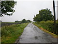
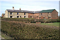
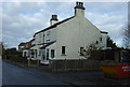
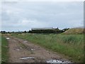
Photos of PR9 8ES


Area Information
PR9 8ES defines a very small residential cluster covering exactly 5.9 hectares. This limited footprint accommodates just 1,261 residents, resulting in a population density of 464 people per square kilometre. You will find this postcode serves as a tightly knit housing pocket rather than a sprawling town centre. The area sits within the PR9 postcode district, a region known for its suburban residential character. Living in PR9 8ES means navigating a compact environment where neighbours are rarely far away. The low total population ensures that daily routines do not involve travelling through heavy traffic clogs common in larger urban centres. Despite its size, the area functions as a complete living unit with direct access to wider regional amenities. Homebuyers here value the manageable scale of the neighbourhood. You can expect a community where local interactions are more frequent because the physical space is constrained. This specific cluster offers a quiet alternative to the busier streets found further afield. The area maintains its distinct identity as a dedicated housing zone.
- Area Type
- Postcode
- Area Size
- 5.9 hectares
- Population
- 1261
- Population Density
- 464 people/km²
The housing landscape in PR9 8ES is overwhelmingly owner-occupied, with 70% of residents owning their homes. This statistic distinguishes the area from vibrant rental markets found in university towns or city centres. Houses are the exclusive accommodation type, which means you will see detached, semi-detached, and terraced homes rather than luxury condominiums or student blocks. Buying homes in PR9 8ES usually involves purchasing freehold properties directly from existing owners seeking to move. The small total population of 1,261 people limits the supply of individual listings at any given time. You will not find large chains of identical modern flats in this postcode. The market appeal lies in traditional property types suited for families or couples seeking stability. Rental properties exist but are outnumbered by owner-occupied stock by more than three to one. This environment suits buyers looking for long-term security rather than investors chasing high-yield rentals. The sheer number of houses available for purchase remains relatively low compared to larger urban postcodes.
House Prices in PR9 8ES
Showing 50 properties
| Address | Type | Beds | Baths | Last Sale Price | Last Sale Date | |
|---|---|---|---|---|---|---|
| 57 Vicarage Lane, Banks, PR9 8ES | Bungalow | - | - | £215,000 | Oct 2025 | |
| 11 Vicarage Lane, Banks, PR9 8ES | Semi-detached | 2 | 1 | £119,000 | Mar 2024 | |
| 19 Vicarage Lane, Banks, PR9 8ES | Semi-detached | 2 | 1 | £165,000 | Dec 2023 | |
| 31 Vicarage Lane, Banks, PR9 8ES | Semi-detached | 3 | 1 | £240,000 | May 2023 | |
| 47 Vicarage Lane, Banks, PR9 8ES | house | - | - | £155,000 | Aug 2021 | |
| 6 Vicarage Lane, Banks, PR9 8ES | house | - | - | £145,000 | May 2021 | |
| 13 Vicarage Lane, Banks, PR9 8ES | Semi-detached | 3 | 1 | £203,000 | Dec 2020 | |
| 10 Vicarage Lane, Banks, PR9 8ES | house | - | - | £235,000 | Nov 2019 | |
| 22 Vicarage Lane, Banks, PR9 8ES | house | - | - | £117,500 | Jul 2019 | |
| 24 Vicarage Lane, Banks, PR9 8ES | house | - | - | £199,950 | Jul 2019 |
Energy Efficiency in PR9 8ES
Residents of PR9 8ES benefit from a diverse range of amenities within practical travelling distance. Five retail locations serve the community, including specific branches like Co-op Banks, Co-op Fylde, and Morrisons Daily. These shops are close enough for weekly grocery runs and essential banking needs. Transport links are well developed with five railway stations nearby, including Meols Cop, Southport, and Bescar Lane. Commuters can access regional train services almost immediately after leaving the postcode. Aviation access is also present with one airport location, Warton Airport, situated nearby. This combination of rail and air options supports灵活 travel. You have access to multiple supermarkets and banking services without enduring long commute times. The proximity to Southport Railway Station offers direct links to larger urban centres if you require them. Shopping trips do not demand significant time away from home. The local retail density ensures that day-to-day errands remain convenient and quick.
Amenities
Schools
| Rank | School | Type | Entry gender | Ages |
|---|
Explore more schools in this area
Go to Schools tabDemographics
The community profile of PR9 8ES reveals a mature population with a median age of 47 years. Most residents fall within the adult bracket of 30 to 64 years, indicating a stable family-oriented demographic rather than a transient student crowd. Home ownership is the dominant housing tenure, with 70% of households owning their property outright or through a mortgage. This high ownership rate signals a settled population deeply rooted in the locality. The predominant ethnic group is White, reflecting the broader demographic trends of the region. Houses form the primary accommodation type, meaning you will encounter few purpose-built apartments or communal flats. You are unlikely to find young professionals seeking short-term lets or shared housing here. The age profile suggests schools near PR9 8ES cater primarily to primary and secondary ages rather than early-years education. This demographic snapshot indicates a quiet, established neighbourhood where residents have likely lived for decades. The lack of significant youth bulges suggests schools will not face overflow enrolments. Families with school-aged children typically form the bulk of the local electorate.
Household Size
Accommodation Type
Tenure
Ethnic Group
Religion
Household Composition
Age
Household Deprivation
NS-SEC
Explore more demographic insights in this area
Go to Demographics tabPlanning
Planning Constraints
- Flood RiskPremium
- Ramsar Wetland SitesPremium
- Area of Outstanding Natural BeautyPremium
- Protected Nature ReservePremium
- Protected WoodlandPremium