Area Overview for PR9 7JE
Photos of PR9 7JE
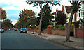
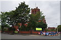
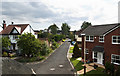
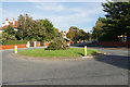
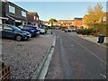
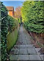
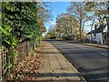
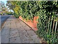
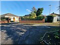
33 photos from this area
Area Information
Key information about the PR9 7JE including its size, population, and administrative classification.
- Area Type
- Postcode
- Area Size
- 2.3 hectares
- Population
- 1388
- Population Density
- 1091 people/km²
House Prices in PR9 7JE
38
Properties
£292,095
Average Sold Price
£79,000
Lowest Price
£510,000
Highest Price
Showing 38 properties
| Address | Type | Beds | Baths | Last Sale Price | Last Sale Date | |
|---|---|---|---|---|---|---|
| 119 Churchgate, Southport, PR9 7JE | Detached | 4 | 1 | £510,000 | Oct 2025 | |
| 123 Churchgate, Southport, PR9 7JE | Detached | 4 | 1 | £482,500 | Jul 2025 | |
| 102 Churchgate, Southport, PR9 7JE | Semi-detached | 3 | 1 | £345,000 | Jun 2025 | |
| 91 Churchgate, Southport, PR9 7JE | Semi-detached | 5 | 1 | £365,000 | May 2024 | |
| 126 Churchgate, Southport, PR9 7JE | Semi-detached | 3 | 1 | £320,000 | Feb 2024 | |
| 121 Churchgate, Southport, PR9 7JE | house | 4 | 3 | £500,000 | Jan 2024 | |
| 120 Churchgate, Southport, PR9 7JE | Retail | 4 | 2 | £405,000 | Sep 2022 | |
| 108 Churchgate, Southport, PR9 7JE | Detached | 3 | 2 | £342,000 | Jul 2021 | |
| 124 Churchgate, Southport, PR9 7JE | Semi-detached | 3 | 1 | £335,000 | May 2021 | |
| 100 Churchgate, Southport, PR9 7JE | house | - | - | £247,000 | Mar 2021 |
Page 1 of 4
Energy Efficiency in PR9 7JE
Amenities
Schools
| Rank | School | Type | Entry gender | Ages |
|---|
Explore more schools in this area
Go to Schools tabDemographics
Household Size
Two person
most common
Accommodation Type
Houses
most common
Tenure
82
majority
Ethnic Group
White
most common
Religion
N/A
most common
Household Composition
N/A
most common
Age
47
median
Adults (30-64 years)
most common
Household Deprivation
N/A
with no deprivation
NS-SEC
40
in Lower managerial occupations
Explore more demographic insights in this area
Go to Demographics tabPlanning
Planning Constraints
- Flood RiskPremium
- Ramsar Wetland SitesPremium
- Area of Outstanding Natural BeautyPremium
- Protected Nature ReservePremium
- Protected WoodlandPremium