Area Overview for PR9 7DZ
Photos of PR9 7DZ
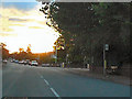
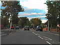
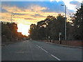
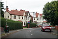
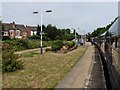
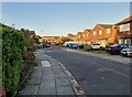
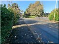
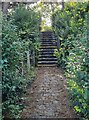
34 photos from this area
Area Information
Key information about the PR9 7DZ including its size, population, and administrative classification.
- Area Type
- Postcode
- Area Size
- 7562 m²
- Population
- 1500
- Population Density
- 6305 people/km²
House Prices in PR9 7DZ
47
Properties
£121,583
Average Sold Price
£32,300
Lowest Price
£185,000
Highest Price
Showing 47 properties
| Address | Type | Beds | Baths | Last Sale Price | Last Sale Date | |
|---|---|---|---|---|---|---|
| 87 Wennington Road, Southport, PR9 7DZ | Semi-detached | 2 | 1 | £185,000 | Nov 2024 | |
| 81 Wennington Road, Southport, PR9 7DZ | Semi-detached | 2 | 1 | £182,000 | Nov 2024 | |
| 93 Wennington Road, Southport, PR9 7DZ | Semi-detached | 2 | 1 | £138,000 | Sep 2018 | |
| 91 Wennington Road, Southport, PR9 7DZ | Semi-detached | 3 | 1 | £168,000 | Sep 2014 | |
| 89 Wennington Road, Southport, PR9 7DZ | house | - | - | £130,000 | Aug 2014 | |
| 85 Wennington Road, Southport, PR9 7DZ | Semi-detached | 2 | 1 | £77,000 | Jul 2011 | |
| 83 Wennington Road, Southport, PR9 7DZ | Semi-detached | - | - | £102,995 | Apr 2003 | |
| 79 Wennington Road, Southport, PR9 7DZ | Semi-detached | 2 | - | £78,950 | Feb 2002 | |
| 82 Wennington Road, Southport, PR9 7DZ | Semi-detached | 4 | - | £32,300 | Oct 1997 | |
| 11, Poulton Court, Wennington Road, Southport, PR9 7DZ | Flat | - | - | - | - |
Page 1 of 5
Energy Efficiency in PR9 7DZ
Amenities
Schools
| Rank | School | Type | Entry gender | Ages |
|---|
Explore more schools in this area
Go to Schools tabDemographics
Household Size
Family (3-5 people)
most common
Accommodation Type
Houses
most common
Tenure
75
majority
Ethnic Group
White
most common
Religion
N/A
most common
Household Composition
N/A
most common
Age
47
median
Adults (30-64 years)
most common
Household Deprivation
N/A
with no deprivation
NS-SEC
30
in Lower managerial occupations
Explore more demographic insights in this area
Go to Demographics tabPlanning
Planning Constraints
- Flood RiskPremium
- Ramsar Wetland SitesPremium
- Area of Outstanding Natural BeautyPremium
- Protected Nature ReservePremium
- Protected WoodlandPremium