Area Overview for PR9 7DR
Photos of PR9 7DR

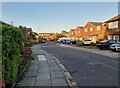
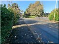

34 photos from this area
Area Information
Key information about the PR9 7DR including its size, population, and administrative classification.
- Area Type
- Postcode
- Area Size
- 9341 m²
- Population
- 1500
- Population Density
- 6305 people/km²
House Prices in PR9 7DR
20
Properties
£194,633
Average Sold Price
£79,000
Lowest Price
£242,000
Highest Price
Showing 20 properties
| Address | Type | Beds | Baths | Last Sale Price | Last Sale Date | |
|---|---|---|---|---|---|---|
| 18 Stretton Drive, Southport, PR9 7DR | Semi-detached | 4 | - | £242,000 | Jun 2018 | |
| 14 Stretton Drive, Southport, PR9 7DR | Semi-detached | 3 | - | £188,000 | Oct 2015 | |
| 1 Stretton Drive, Southport, PR9 7DR | house | - | - | £172,250 | Aug 2013 | |
| 4 Stretton Drive, Southport, PR9 7DR | house | - | - | £233,000 | Mar 2013 | |
| 20 Stretton Drive, Southport, PR9 7DR | house | - | - | £200,000 | Apr 2009 | |
| 17 Stretton Drive, Southport, PR9 7DR | Semi-detached | - | - | £229,950 | Oct 2006 | |
| 9 Stretton Drive, Southport, PR9 7DR | house | - | - | £227,500 | Aug 2005 | |
| 6 Stretton Drive, Southport, PR9 7DR | Semi-detached | - | - | £180,000 | Aug 2003 | |
| 19 Stretton Drive, Southport, PR9 7DR | Semi-detached | - | - | £79,000 | Nov 1998 | |
| 5 Stretton Drive, Southport, PR9 7DR | Semi-detached | - | - | - | - |
Page 1 of 2
Energy Efficiency in PR9 7DR
Amenities
Schools
| Rank | School | Type | Entry gender | Ages |
|---|
Explore more schools in this area
Go to Schools tabDemographics
Household Size
Family (3-5 people)
most common
Accommodation Type
Houses
most common
Tenure
75
majority
Ethnic Group
White
most common
Religion
N/A
most common
Household Composition
N/A
most common
Age
47
median
Adults (30-64 years)
most common
Household Deprivation
N/A
with no deprivation
NS-SEC
30
in Lower managerial occupations
Explore more demographic insights in this area
Go to Demographics tabPlanning
Planning Constraints
- Flood RiskPremium
- Ramsar Wetland SitesPremium
- Area of Outstanding Natural BeautyPremium
- Protected Nature ReservePremium
- Protected WoodlandPremium