Area Overview for PR9 0WA
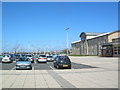
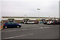
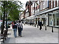
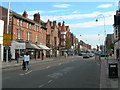
Photos of PR9 0WA


Area Information
Living in PR9 0WA means residing within a specific small residential cluster in England with a total population of 1029 residents. This postcode covers a compact neighbourhood rather than spread-out suburbs, creating a tight-knit environment where houses are in close proximity. You will find that daily life revolves around accessibility and immediate local support, as this small area functions as an interconnected part of the wider Southport community. The location sits within a residential zone where the focus is on practical living rather than sprawling development. Residents benefit from being part of a defined cluster that offers specific convenience while maintaining a sense of locality. The area is characterised by its density, which ensures that essential services and transport links are never far away. When you walk through PR9 0WA, you are stepping into a community defined by its manageable scale and direct access to major towns. This setup makes it ideal for those who prefer a walkable environment with established amenities nearby. The small population size ensures rapid community recognition, yet the area remains a functional node in the regional network. Commuters in postcode PR9 0WA move quickly into nearby towns like Southport, benefiting from the area's strategic placement. Your daily routine involves short trips to local shops or trains without waiting for long-term development changes. The environment is stable and established, offering a clear picture of what life looks like without the uncertainty of new construction projects.
- Area Type
- Postcode
- Area Size
- Not available
- Population
- 1029
- Population Density
- 3291 people/km²
The property market in PR9 0WA is defined by a clear dominance of rental accommodation, with only 16% of homes held by owners. This statistic reveals a sector heavily weighted towards flats, which matches the predominant accommodation type recorded for this postcode. You are looking at a landscape of flats rather than detached houses or semi-detached properties. For buyers considering PR9 0WA, this means competition will centre on leasehold arrangements and rental yields rather than standard freehold purchases. Investors targeting this area should note that the low ownership rate creates a specific niche for portfolio landlords. The concentration of flats makes it an attractive option for those seeking multiple dwellings in a single cluster. However, you must weigh this against the implications of managing a high volume of tenants in a small footprint. The market does not offer the traditional family home scenario; instead, it presents a collection of upper and ground-floor units designed for efficiency. Subsequent sections of the housing stock in PR9 0WA and surrounding areas likely mirror this high-density pattern. You will find that properties here cater to professionals or shared living arrangements given the large number of renters. The area lacks thecharacteristics of a family pocket where owners build equity over decades. Instead, the market responds to immediate occupancy needs driven by the age profile and rental demand. If you are browsing homes in PR9 0WA, expect to see listings focused on mobility and access rather than extensive private gardens.
House Prices in PR9 0WA
No properties found in this postcode.
Energy Efficiency in PR9 0WA
Your lifestyle in PR9 0WA revolves around practical amenities within easy reach of your home. You do not need to travel far for groceries as Tesco Chapel, M&S Southport, and Sainsburys Southport are just a short distance away. These supermarkets provide your food shopping needs with minimal travel time. For those who enjoy shopping for non-essentials, M&S Southport offers a convenient location closer to local rail hubs. Getting to work or attending meetings is straightforward with five railway stations in your vicinity. Southport Railway Station, Birkdale Railway Station, and Meols Cop Railway Station are all notable options for your daily commute. You can choose which station best fits your schedule, as they offer connections to various destinations across the north-west. This variety gives you flexibility in your travel plans without needing to rely on a single transport line. The area also offers unique access via RAF Woodvale, a nearby airfield. This nearby amenity caters to specific leisure or logistical needs available only to a small postcode range. Your daily life in PR9 0WA is characterised by this mix of retail convenience and efficient transport links. You can shop for fresh produce at Sainsburys or manage household budgets at Tesco without a lengthy drive. The proximity to these facilities ensures that running errands takes only minutes rather than hours.
Amenities
Schools
| Rank | School | Type | Entry gender | Ages |
|---|
Explore more schools in this area
Go to Schools tabDemographics
The community in PR9 0WA is dominated by adults, with the most common age range falling between 30 and 64 years. The median age across this postcode is 47, indicating a mature demographic that has moved past early career stages or young adulthood. This suggests a stable population where many residents are settled in their careers and families. White residents form the predominant ethnic group within this cluster. Home ownership stands at 16%, which indicates that the majority of residents in PR9 0WA are private renters. This high rental proportion shapes the local dynamic, creating a transient but steady community where long-term tenancies coexist with new moves every year. The housing stock consists primarily of flats, reflecting a design suited to density and shared living spaces. This arrangement is common in Swansea and similar postcodes where land value dictates vertical rather than horizontal development. With such a low ownership rate, you will likely be asking about rental rights and leasehold terms rather than mortgage eligibility. The lack of owner-occupiers means the area does not have the long-term investment stability found in residential zones. However, the age profile offers reassurance; you will encounter neighbours who are likely experienced in local governance and community matters. The population structure ensures that the area supports families and professionals who value convenience over the prestige of owning property.
Household Size
Accommodation Type
Tenure
Ethnic Group
Religion
Household Composition
Age
Household Deprivation
NS-SEC
Explore more demographic insights in this area
Go to Demographics tabPlanning
Planning Constraints
- Flood RiskPremium
- Ramsar Wetland SitesPremium
- Area of Outstanding Natural BeautyPremium
- Protected Nature ReservePremium
- Protected WoodlandPremium