Area Overview for PR9 0TL
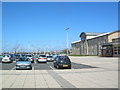
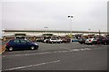
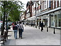
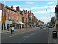
Photos of PR9 0TL


Area Information
PR9 0TL functions as a compact residential cluster defined by its specific postcode boundaries. This small area covers just 1.2 hectares and accommodates a population of 1029 residents. Despite its modest footprint, the density reaches 86313 people per square kilometre, creating a closely knit environment. You can expect a living situation characterised by shared proximity rather than sprawling distances. The concentration of inhabitants means services and neighbours are inevitably close to hand. Daily life here revolves around the immediate community structure rather than exploration of distant zones. This high density suggests a focus on efficient use of space within a defined residential zone. Living in PR9 0TL offers a direct connection to the surrounding infrastructure without the buffer of larger urban sprawls. The area represents a specific slice of the Southport housing market where living in PR9 0TL requires accepting tight quarters with the assurance of established neighbourhood dynamics. You operate within a clearly mapped segment of the town where every home is part of this high-density fabric.
- Area Type
- Postcode
- Area Size
- 1.2 hectares
- Population
- 1029
- Population Density
- 86313 people/km²
Homes in PR9 0TL are primarily flats within a high-density configuration. With only 16% of the population owning their homes, the area operates largely as a rental market. You will find few semi-detached houses or stand-alone properties within the 1.2-hectare boundary. The property stock is uniform, consisting almost entirely of flat accommodation units. This lack of diversity in housing types means you cannot search for a detached bungalow or a large family home in this specific postcode. The low ownership rate suggests a dynamic leasehold market where investors and landlords play a major role. Buyers looking for PR9 0TL specifically should adjust their expectations regarding plot size and house style. If you require a house with a garden or distinct architectural character, this location will not meet those needs. The market here is driven by the availability of flats within the current cluster. Home ownership remains rare, reinforcing the idea that this postcode serves a tenant-heavy demographic. Prospective buyers must approach this area with the understanding that their options are limited to flats in a dense urban setting.
House Prices in PR9 0TL
Showing 35 properties
| Address | Type | Beds | Baths | Last Sale Price | Last Sale Date | |
|---|---|---|---|---|---|---|
| 21 Wright Street, Southport, PR9 0TL | Terraced | 2 | 1 | £97,500 | Oct 2017 | |
| 25 Wright Street, Southport, PR9 0TL | house | - | - | £95,500 | Nov 2013 | |
| 15 Wright Street, Southport, PR9 0TL | Terraced | - | - | £55,000 | Dec 2002 | |
| 23 Wright Street, Southport, PR9 0TL | house | 3 | - | £64,000 | Oct 2002 | |
| 19 Wright Street, Southport, PR9 0TL | Terraced | - | - | £40,000 | Aug 1996 | |
| 17 Wright Street, Southport, PR9 0TL | Terraced | 2 | 1 | - | - | |
| 4 Wright Street, Southport, PR9 0TL | Flat | - | - | - | - | |
| 7 Wright Street, Southport, PR9 0TL | undefined | - | - | - | - | |
| 4, Elizabeth Court, 27B Wright Street, Southport, PR9 0TL | Flat | - | - | - | - | |
| 1, Elizabeth Court, 27B Wright Street, Southport, PR9 0TL | Flat | - | - | - | - |
Energy Efficiency in PR9 0TL
Amenities within practical reach of PR9 0TL offer essential convenience for daily life. Your weekly shopping trips could involve a stop at Sainsburys Southport or Tesco Chapel. Both major supermarkets are located nearby, providing a wide range of groceries at short travel times. M&S Southport also serves the retail needs of the community for clothing and household goods. For those commuting by train, several rail stations are accessible including Southport Railway Station, Meols Cop Railway Station, and Birkdale Railway Station. Choice of train line depends on your specific destination but the proximity ensures reliable rail access. You might also utilise RAF Woodvale if air travel logistics are within your scope, though this is a minor option compared to the rail network. The concentration of retail outlets means you do not need to travel far for basic necessities. Living in PR9 0TL allows you to keep your shopping and travel needs local. The presence of these specific venues creates a functional lifestyle where daily errands remain close to home. You gain access to established brands and transport links without leaving the immediate region.
Amenities
Schools
| Rank | School | Type | Entry gender | Ages |
|---|
Explore more schools in this area
Go to Schools tabDemographics
The community profile for PR9 0TL reflects an established population with a median age of 47 years. The most common age range spans adults between 30 and 64 years, indicating a settled demographic rather than a family-dominant or youth-heavy zone. This age distribution shapes the local economy and social activities significantly. Home ownership stands at 16%, which places the majority of the population within the renting sector. You are more likely to encounter tenants here than owners-occupiers. The predominant ethnic group in this postcode is White, aligning with broader national trends in this region. Accommodation is almost exclusively flats, a distinction that defines the physical reality of the neighbourhood. This uniformity in housing type supports the high-density figure you encountered earlier. With over three-quarters of residents renting, the area functions as a significant rental hub. Living in PR9 0TL means sharing a space with a community that values the flexibility of tenancy over the permanence of ownership. The age profile and accommodation types combine to create a stable, though transient, residential pattern.
Household Size
Accommodation Type
Tenure
Ethnic Group
Religion
Household Composition
Age
Household Deprivation
NS-SEC
Explore more demographic insights in this area
Go to Demographics tabPlanning
Planning Constraints
- Flood RiskPremium
- Ramsar Wetland SitesPremium
- Area of Outstanding Natural BeautyPremium
- Protected Nature ReservePremium
- Protected WoodlandPremium