Area Overview for PR9 0QL
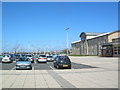
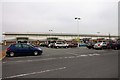
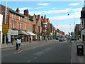
Photos of PR9 0QL


Area Information
PR9 0QL represents a specific postcode area covering a tightly knit residential cluster south of Southport. With a total population of 1,126 people, this location functions as a quiet sleepingsite rather than a bustling commercial hub. Daily life largely revolves around proximity to larger retail parks and railway stations, as the cluster itself has limited standalone services. Residents typically commute to wider Merseyside infrastructure for major employment or shopping trips. The area serves as a practical residential option where house values are influenced by broader regional trends rather than unique local landmarks. Living in PR9 0QL means prioritising accessibility over immediate neighbourhood character. Your commute will likely involve a short drive or a train journey to stations further afield. The layout supports families or individuals who value logging off at the end of the day to return to a small, defined community space. It is a functional address where the surrounding postcode districts provide the bulk of urban amenities.
- Area Type
- Postcode
- Area Size
- Not available
- Population
- 1126
- Population Density
- Not available
The property market in PR9 0QL is defined by a distinct leaning towards rental accommodation. With only 39% home ownership, the area is not primarily owner-occupied. Flats dominate the housing stock, meaning most homes in this postcode are likely low-rise apartments or purpose-built blocks rather than detached villas. This structure suggests the area suits first-time buyers or investors looking to purchase smaller units, though the high rental proportion reflects its status as an entry point into the local estate. Those looking for a standalone family estate home would need to look at adjacent postcodes where housing variety might differ. Living in PR9 0QL typically involves navigating a market where fixed-term tenancies are just as common as purchases. The concentration of flats aligns with the population density of roughly 1,126 people in a small cluster. Buyers should expect prices to be influenced by regional demand in Southport rather than unique local scarcity.
House Prices in PR9 0QL
No properties found in this postcode.
Energy Efficiency in PR9 0QL
Your lifestyle in PR9 0QL centres on accessing key amenities just a short distance away. Five retail units operate within practical reach, providing essentials for your weekly shop. You can visit Iceland Southport, Morrisons Southport, or Tesco Southport for groceries and household necessities. This concentration of supermarkets ensures you do not need to travel far for daily provisions. Retail diversity is limited to these three major chains, so you will find standard offerings rather than boutique shopping. Beyond food, travel connectivity offers significant leisure potential with five nearby railway stations. You can easily reach entertainment venues, parks, or city centres via Southport Railway Station, Birkdale Railway Station, or Meols Cop Railway Station. The area does not boast its own dedicated parks or leisure complexes within the immediate postcode boundary. Instead, your recreational life depends on the attractions accessible from the surrounding district, balancing convenience in shopping with proximity to wider regional facilities.
Amenities
Schools
| Rank | School | Type | Entry gender | Ages |
|---|
Explore more schools in this area
Go to Schools tabDemographics
The community in PR9 0QL is dominated by adults aged between 30 and 64 years. This age range constitutes the most common demographic within the 1,126 residents. The median age sits at 47, confirming that families with children and commuters in mid-career stages define the local social fabric. House ownership stands at 39%, indicating that the majority of residents rent their properties. Flats represent the predominant accommodation type, suggesting a high density of apartment living rather than detached houses. The population is ethnically White, reflecting the broader makeup of the Southport district. While specific data on deprivation levels is not included in the provided records, the age profile suggests a stable, perhaps empty-nester or young-family demographic. With almost two-thirds of residents renting, the area may see more transient tenants or long-term renters compared to owner-occupied zones. This rental-heavy environment often correlates with a community focused on transient needs alongside established roots.
Household Size
Accommodation Type
Tenure
Ethnic Group
Religion
Household Composition
Age
Household Deprivation
NS-SEC
Explore more demographic insights in this area
Go to Demographics tabPlanning
Planning Constraints
- Flood RiskPremium
- Ramsar Wetland SitesPremium
- Area of Outstanding Natural BeautyPremium
- Protected Nature ReservePremium
- Protected WoodlandPremium