Area Overview for PR9 0PB
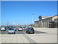
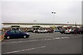
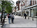
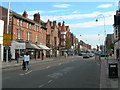
Photos of PR9 0PB


Area Information
Living in PR9 0PB means residing in a specific postcode area covering a small residential cluster with a total population of 1,029. This compact community offers a defined environment where daily life revolves around close proximity to key transport links and essential retail outlets. The area serves as a discrete neighbourhood where residents rely on nearby stations and shops for their routine needs. You will find yourself in a setting where the built environment is closely managed within a small geographic footprint. This locality functions as a straightforward address for those seeking a defined residential zone near Southport. The character of PR9 0PB is shaped by its status as a tightly knit cluster rather than a sprawling suburb. Your immediate surroundings include direct access to major railway hubs and national retailers. The area represents a practical choice for individuals who value a clear, contained location with established connections to wider infrastructure. It is a place where the boundaries of your daily commute and local errands are naturally limited to a highly accessible zone.
- Area Type
- Postcode
- Area Size
- Not available
- Population
- 1029
- Population Density
- 3291 people/km²
The property market in PR9 0PB is dominated by rental accommodation rather than owner-occupied homes. Statistics show that only 16% of the population owns their homes, meaning the vast majority live in rental properties. This imbalance suggests a market heavily oriented toward tenants seeking flexible tenancies within this small cluster. Homes in PR9 0PB are almost exclusively flats, and you will not find a high concentration of standalone houses in this specific postcode. The disparity between ownership and rental suggests a specific type of housing stock, likely including social or private sector flats. Buyers looking at homes in PR9 0PB need to understand that purchasing a freehold property here is statistically rare compared to renting. The area functions primarily as a residential hub for those not yet able to purchase a standalone home. The dominance of flats aligns with the need for accessible, often urban-centric living arrangements typical of this demographic. This market structure defines the nature of transactions in this small geographical area.
House Prices in PR9 0PB
No properties found in this postcode.
Energy Efficiency in PR9 0PB
Your lifestyle in PR9 0PB benefits from immediate access to five retail outlets, including Tesco Chapel, Sainsburys Southport, and M&S Southport. These national supermarkets allow you to complete your weekly shopping without needing a car for long distances. You also have access to five railway stations within practical reach, ensuring direct links to Southport Railway Station, Birkdale Railway Station, and Meols Cop Railway Station. This transport network places the airport option of RAF Woodvale nearby should you need air travel logistics. Living in PR9 0PB offers convenience through the proximity of major national chains and public transport hubs. You can walk or take a short bus ride to stock your pantry or catch a train for city commutes. The presence of multiple retail and rail options provides a practical advantage for families and professionals alike. These amenities form the backbone of daily life, removing the need for extensive travel into Southport town centre.
Amenities
Schools
| Rank | School | Type | Entry gender | Ages |
|---|
Explore more schools in this area
Go to Schools tabDemographics
The community within PR9 0PB features a distinct age profile with a median age of 47 years. Adults aged between 30 and 64 years constitute the most common age range in the area. This demographic skew suggests a population comprising three-quarters of the residents are mature individuals likely settled in their careers or families. Home ownership stands at a low 16%, indicating that a significant majority of residents rely on renting rather than owning their primary residence. The predominant accommodation type found in homes near this postcode consists of flats. Most people living in PR9 0PB reside in these flat units rather than detached or semi-detached houses. The population is predominantly White, reflecting the local ethnic composition of this specific cluster. You will find a mature community where a vast number of adults define the local character. The low ownership rate shapes the economic dynamics and potentially the stability of tenancies within this specific postcode sector.
Household Size
Accommodation Type
Tenure
Ethnic Group
Religion
Household Composition
Age
Household Deprivation
NS-SEC
Explore more demographic insights in this area
Go to Demographics tabPlanning
Planning Constraints
- Flood RiskPremium
- Ramsar Wetland SitesPremium
- Area of Outstanding Natural BeautyPremium
- Protected Nature ReservePremium
- Protected WoodlandPremium