Area Overview for PR9 0BW
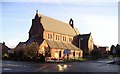
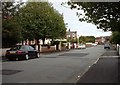
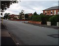
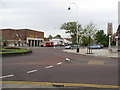
Photos of PR9 0BW


Area Information
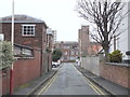
Living in PR9 0BW means residing in a very specific postcode area covering a small cluster of homes. This residential zone contains a population of 1,171 people within just 340 square metres of mapped land. Such density creates a tightly knit environment where neighbours are likely to know one another well. The area sits in England and functions as a distinct pocket within the wider property landscape. Buyers considering this location should understand that they are purchasing a home in a hyper-localised setting with limited physical spread. Daily life here revolves around proximity to essential services rather than walking distance through green belts or expansive neighbourhoods. Research indicates that approximately 32 per cent of residents own their homes, suggesting a significant portion of the population might operate within the private rental sector. The surrounding infrastructure supports a mix of workers, commuters and families who rely heavily on nearby transport links. Understanding the specific constraints of this postcode area is vital for anyone constructing their long-term housing strategy. You must weigh the intimate scale of PR9 0BW against your need for space and privacy.
- Area Type
- Postcode
- Area Size
- 340 m²
- Population
- 1171
- Population Density
- 3447044 people/km²
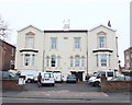
The property market in PR9 0BW is defined by a high reliance on rented accommodation. Data shows that only 32 per cent of households own their homes, meaning two-thirds of residents are likely tenants. This skew demonstrates that the area does not function as a primary target for first-time buyer ownership or legacy estates passed down through generations. Accommodation types are dominated by flats, which occupy the bulk of the residential stock in this cluster. This structure suits the high-density nature of the site, where 1,171 people live across a compact 340 square metres. Potential buyers should recognise that freestanding houses or semi-detached properties are unlikely to be available here. The market consists almost entirely of apartment living within a confined geographical boundary. For investors or landlords, the low ownership rate presents opportunities, yet the scarcity of individual units may limit inventory volume. Families considering spaces to raise children must carefully evaluate whether these flat-based environments offer sufficient room. The absence of traditional garden plots or larger terraced homes is a defining feature of this postcode sector. You cannot expect the variety of housing styles found in larger boroughs when purchasing homes in PR9 0BW.
House Prices in PR9 0BW
Showing 2 properties
| Address | Type | Beds | Baths | Last Sale Price | Last Sale Date | |
|---|---|---|---|---|---|---|
| Flat 2, 5 Gordon Way, Southport, PR9 0BW | Flat | 6 | 3 | - | - | |
| Flat 1, 5 Gordon Way, Southport, PR9 0BW | Flat | - | - | - | - |
Energy Efficiency in PR9 0BW
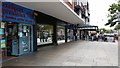
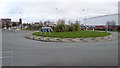
Your daily lifestyle in PR9 0BW depends heavily on the amenities located in the immediate vicinity. Five retail destinations operate within walking distance, including Farmfoods Southport, Tesco Hesketh, and Sainsburys Southport. These supermarkets provide comprehensive grocery options without requiring a lengthy drive through the Lancashire countryside. Transport accessibility is bolstered by five nearby railway stations. Southport Railway Station, Meols Cop Railway Station, and Birkdale Railway Station form the backbone of local connectivity. Travelers can access these hubs quickly, reducing the time spent navigating road traffic. The presence of RAF Woodvale further connects this neighbourhood to broader regional networks. While the residential area itself is compact, the surrounding infrastructure keeps daily errands efficient. You can shop for fresh produce at Tesco Hesketh or finalise household budgets at Sainsburys Southport before catching a train from one of the five nearby stations. The convenience factor is high, especially for those who prefer public transport over driving. Living here offers a straightforward routine where basic needs are met without excessive travel.
Amenities
Schools
| Rank | School | Type | Entry gender | Ages |
|---|
Explore more schools in this area
Go to Schools tabDemographics
The community profile of PR9 0BW centres on adults, with the most common age range falling between 30 and 64 years. The median age for residents here is 47 years old, indicating a mature demographic that has arguably settled permanently rather than passing through as students or young professionals. This age distribution suggests a neighbourhood where families and mature individuals prioritise stability over transient living arrangements. Home ownership stands at exactly 32 per cent within this cluster. This statistic implies that a substantial majority of households are tenants rather than owners. The predominant accommodation type in PR9 0BW is flats, which aligns with the high density and smaller physical footprint of the area. The ethnic composition is predominantly White, reflecting the traditional demographic character of this specific southern England location. Households in this area are largely established, with a median age that points towards residents who have down-sized or sought stability later in their career lives. There is no significant youth population or transient student presence evident in the recorded figures. The lack of young adults under 30 suggests limited demand for single-bed units geared towards entry-level workers. Instead, the housing stock caters to those seeking permanence in a flat-based environment.
Household Size
Accommodation Type
Tenure
Ethnic Group
Religion
Household Composition
Age
Household Deprivation
NS-SEC
Explore more demographic insights in this area
Go to Demographics tabPlanning
Planning Constraints
- Flood RiskPremium
- Ramsar Wetland SitesPremium
- Area of Outstanding Natural BeautyPremium
- Protected Nature ReservePremium
- Protected WoodlandPremium