Area Overview for PR9 0BE
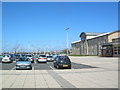
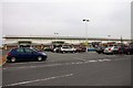
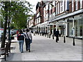
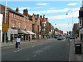
Photos of PR9 0BE


Area Information
Living in PR9 0BE means residing within a very compact residential cluster defined by postcode England. This specific location covers a tiny footprint of only 1002 square metres, serving a population of 1171 residents. The area is designed for those who prioritise proximity over sprawl, offering a dense living environment where neighbours are close by. Given the limited physical space, daily life revolves entirely around the immediate surroundings and what lies within a short journey. The cluster acts as a gateway for those accessing services in Southport and Hesketh without needing to commute far from home. You will find yourself surrounded by a tight-knit community where every individual counts due to the small population density relative to the land size. This postcode represents a functional part of the wider PR9 region, providing a base for residents who want a quiet pocket of living while remaining connected to larger towns. The area does not boast vast open spaces; instead, it offers a concentrated living experience typical of specific postcode sectors. For families or individuals seeking a defined home base, this location delivers a clear identity within the local landscape. Understanding the scale of PR9 0BE helps you realise that your home is part of a larger, interconnected network of streets and properties.
- Area Type
- Postcode
- Area Size
- 1002 m²
- Population
- 1171
- Population Density
- 7059 people/km²
The property market in PR9 0BE is distinctly characterised by high rental occupancy and a shortage of owner-occupied homes. With only 32% home ownership, the area functions primarily as a rental hub rather than a retirement or investment haven for owner-builders. Flats are the standard accommodation type, indicating a market focused on efficient, multi-unit buildings rather than sprawling family estates. This structure appeals to professional workers or students who wish to live centrally without the long-term commitment of buying a house. Buyers looking to purchase here must understand that the majority of properties are likely rented out to tenants passing through or working long-term. The small total area of 1002 square metres restricts the number of new constructions, meaning the existing stock remains in high demand. You will find few traditional family homes, so to secure a standalone property here is challenging. Those considering new purchases should evaluate whether the flat model suits their lifestyle needs regarding privacy and space. The dominance of flat life suggests a neighbourliness but also less noise insulation compared to detached houses. For investors, the low owner occupancy rate signals strong rental potential, while first-time buyers face a competitive landscape in a saturated smaller market. The property type dictates a daily life oriented towards shared corridors and communal spaces rather than private gardens.
House Prices in PR9 0BE
Showing 1 properties
| Address | Type | Beds | Baths | Last Sale Price | Last Sale Date | |
|---|---|---|---|---|---|---|
| 583-587 Lord Street, Southport, PR9 0BE | hotel | - | - | - | - |
Energy Efficiency in PR9 0BE
Your daily lifestyle in PR9 0BE depends on the cluster of amenities reachable within practical driving time or public transport links. Five retail outlets serve the shopping needs of residents, including Farmfoods Southport, Sainsburys Southport, and Tesco Hesketh. These stores provide essential groceries and household necessities without requiring a long trek into the city centre. Five railway stations lie nearby, offering Southport Railway Station, Meols Cop Railway Station, and Birkdale Railway Station as key transit points. This rail access allows you to commute quickly to Jobcentre Plus offices, schools, or workplaces in Southport or beyond. One airport, RAF Woodvale, stands in the vicinity, contributing to the transport network even if it does not handle commercial passenger flights directly. The combination of multiple supermarkets and railway hubs means you can parcel your day between local errands and regional travel. Dining options are likely limited on-site at the postcode level, so you often travel to the larger towns in Southport for restaurant experiences. The area functions as a transport hub surrounded by larger commercial centres rather than being a commercial centre itself. You gain convenience through the sheer number of reachable stations and supermarkets within short reach of your door.
Amenities
Schools
| Rank | School | Type | Entry gender | Ages |
|---|
Explore more schools in this area
Go to Schools tabDemographics
The community in PR9 0BE reflects a mature population with a median age of 47 years. Most residents fall into the adult age range between 30 and 64 years, indicating a neighbourhood stable enough to avoid the transience often found in younger estates. Only 32% of the population owns their homes, meaning the majority of households rely on the rental market for their accommodation. This statistic shapes the local economy and social stability, creating a dynamic where tenants make up the bulk of the demographic. Flats form the predominant accommodation type, suggesting a building stock adapted to urban living rather than detached family homes. The area is overwhelmingly White, with no significant ethnic diversity recorded in the available data. This homogeneity contributes to a predictable social environment for those value familiarity in their daily routines. While specific deprivation data is not available in the current records, the high concentration of flats and lower home ownership suggests a likely mix of professional renters and occasional owners. Young adults and older empty-nesters probably dominate the housing stock, given the median age and flat-heavy inventory. This demographic profile points towards an area attractant to those seeking convenience over ownership, perhaps closer to city centres or employment hubs rather than rural retreats.
Household Size
Accommodation Type
Tenure
Ethnic Group
Religion
Household Composition
Age
Household Deprivation
NS-SEC
Explore more demographic insights in this area
Go to Demographics tabPlanning
Planning Constraints
- Flood RiskPremium
- Ramsar Wetland SitesPremium
- Area of Outstanding Natural BeautyPremium
- Protected Nature ReservePremium
- Protected WoodlandPremium