Area Overview for PR8 6LY
Photos of PR8 6LY

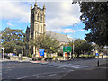
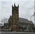
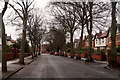

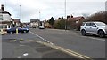
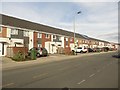
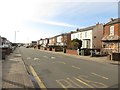
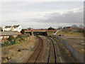
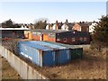
56 photos from this area
Area Information
Key information about the PR8 6LY including its size, population, and administrative classification.
- Area Type
- Postcode
- Area Size
- 1.1 hectares
- Population
- 1521
- Population Density
- 5082 people/km²
House Prices in PR8 6LY
28
Properties
£162,050
Average Sold Price
£50,000
Lowest Price
£290,000
Highest Price
Showing 28 properties
| Address | Type | Beds | Baths | Last Sale Price | Last Sale Date | |
|---|---|---|---|---|---|---|
| 132 Southbank Road, Southport, PR8 6LY | house | 3 | 1 | £225,000 | Feb 2025 | |
| 150 Southbank Road, Southport, PR8 6LY | Semi-detached | 3 | 2 | £290,000 | Mar 2024 | |
| 156 Southbank Road, Southport, PR8 6LY | Retail | 4 | 1 | £264,000 | Nov 2022 | |
| 160 Southbank Road, Southport, PR8 6LY | house | - | - | £218,000 | Jan 2022 | |
| 140 Southbank Road, Southport, PR8 6LY | Semi-detached | 4 | 2 | £191,000 | Oct 2020 | |
| 133 Southbank Road, Southport, PR8 6LY | Semi-detached | - | - | £207,000 | Apr 2016 | |
| 131 Southbank Road, Southport, PR8 6LY | Semi-detached | 4 | 1 | £192,000 | Apr 2014 | |
| 134 Southbank Road, Southport, PR8 6LY | Semi-detached | 3 | - | £149,200 | Jan 2014 | |
| 136 Southbank Road, Southport, PR8 6LY | house | - | - | £150,000 | Sep 2013 | |
| 164 Southbank Road, Southport, PR8 6LY | house | - | - | £85,000 | Apr 2011 |
Page 1 of 3
Energy Efficiency in PR8 6LY
Amenities
Schools
| Rank | School | Type | Entry gender | Ages |
|---|
Explore more schools in this area
Go to Schools tabDemographics
Household Size
Family (3-5 people)
most common
Accommodation Type
Houses
most common
Tenure
60
majority
Ethnic Group
White
most common
Religion
N/A
most common
Household Composition
N/A
most common
Age
47
median
Adults (30-64 years)
most common
Household Deprivation
N/A
with no deprivation
NS-SEC
28
in Lower managerial occupations
Explore more demographic insights in this area
Go to Demographics tabPlanning
Planning Constraints
- Flood RiskPremium
- Ramsar Wetland SitesPremium
- Area of Outstanding Natural BeautyPremium
- Protected Nature ReservePremium
- Protected WoodlandPremium