Area Overview for PR8 4ST
Photos of PR8 4ST

Area Information
Living in PR8 4ST means residing within a tightly knit residential cluster covering just 1.4 hectares. This specific postcode area forms part of a small locality where 1,649 people call home. The high population density of 120,339 people per square kilometre creates an intense concentration of householders in a limited space. You will find a environment defined by proximity to immediate neighbours rather than expansive private grounds or wide-open spaces. Daily life centres around a very compact footprint where services and residences are in close contact. Such a setting suits those who prioritise efficiency and neighbourly familiarity over secluded living. The sheer number of residents relative to the land area suggests a full, active neighbourhood where the community filling out the streets is substantial. This small area forms a distinct pocket within the broader local landscape. Making a move here offers a focused slice of residential life where individual homes sit close together. The compact nature of PR8 4ST ensures that nothing is truly far away, even if the physical distance between neighbours is very short.
- Area Type
- Postcode
- Area Size
- 1.4 hectares
- Population
- 1649
- Population Density
- 5003 people/km²
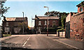
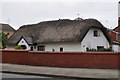
This postcode area presents a distinct market profile driven by a stock almost entirely composed of houses. With 75% of properties in PR8 4ST owned by residents, the area functions principally as an owner-occupied zone rather than a rental hub. You will struggle to find purpose-built flats or apartments within this specific 1.4-hectare cluster. Instead, the housing consists of traditional homes accommodating the median age of 47 years old. This high ownership figure suggests that properties here pass between generations or are bought as substantial family investments. For a buyer, the prospect of purchasing in PR8 4ST means entering a market where competition often revolves around single-family dwellings. The lack of flats means smaller households or those seeking terraced or semi-detached options will find their primary choices concentrated here. Solving your housing needs in this area requires targeting the existing stock of houses which form the backbone of the 1,649 resident population. Rental options are naturally scarcer in a zone where four out of five homes belong to the actual occupants. When you view homes for sale, expect to see a variety of residential standards fitting the 120,339 people per square kilometre density constraints. The market is defined by this singular focus on house ownership and the stability that brings to the local property values.
House Prices in PR8 4ST
Showing 34 properties
| Address | Type | Beds | Baths | Last Sale Price | Last Sale Date | |
|---|---|---|---|---|---|---|
| 32 Walmer Road, Birkdale, PR8 4ST | house | 6 | 6 | £800,000 | Sep 2023 | |
| 36 Walmer Road, Birkdale, PR8 4ST | house | - | - | £350,000 | Feb 2019 | |
| 22 Walmer Road, Birkdale, PR8 4ST | Detached | 4 | 3 | £369,950 | Sep 2018 | |
| 20A Walmer Road, Birkdale, PR8 4ST | Semi-detached | 4 | - | £330,000 | Nov 2017 | |
| 26 Walmer Road, Birkdale, PR8 4ST | house | 3 | - | £231,500 | Apr 2015 | |
| 38 Walmer Road, Birkdale, PR8 4ST | house | - | - | £360,000 | Aug 2013 | |
| 28 Walmer Road, Birkdale, PR8 4ST | house | 3 | - | £165,000 | Mar 2013 | |
| 43 Walmer Road, Birkdale, PR8 4ST | house | - | - | £310,000 | Jan 2011 | |
| 41 Walmer Road, Birkdale, PR8 4ST | house | - | - | £270,000 | Oct 2003 | |
| 40 Walmer Road, Birkdale, PR8 4ST | house | - | - | £190,000 | Jul 2003 |
Energy Efficiency in PR8 4ST
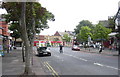
Daily life in PR8 4ST benefits from immediate access to essential retail and transport hubs within practical reach. You can easily visit Sainsburys Birkdale, Spar, and Morrisons Daily for your weekly shopping requirements. These five retail outlets provide a convenient supply chain for food and general goods without requiring a long journey. Public transport links are similarly nearby with Birkdale Railway Station, Hillside Railway Station, and Southport Railway Station offering rail connections. Choosing PR8 4ST places you near three railway stations that facilitate travel to wider destinations. Additionally, RAF Woodvale sits close to the locality, offering a specific landmark reference point in the transport network. While the area itself contains no large leisure parks or cinemas, the density of 120,339 people per square kilometre ensures that commercial services are clustered very closely together. The presence of five retail counters and five nearby station points creates a functional lifestyle circle. You can manage most common errands and commute needs using these nearby facilities. The character of the area relies on this strong logistical support rather than large-scale entertainment venues directly within the 1.4-hectare boundary. Shopping and travelling are quick, straightforward transactions for a resident of this postcode.
Amenities
Schools
| Rank | School | Type | Entry gender | Ages |
|---|
Explore more schools in this area
Go to Schools tabDemographics
The community in PR8 4ST is dominated by long-term residents where 75% of homes are owner-occupied. This high rate indicates a stable neighbourhood where most households have purchased their properties and settled deeply into the area. The majority of residents fall into the adult age range between 30 and 64 years old. The local demographic profile places the median age at 47, confirming a mature population base. Children under ten form a very small proportion of the 1,649 total residents. You will find a house-centric environment rather than one populated with flats or high-density blocks. The accommodation type is exclusively houses, reflecting the traditional character of this postcode. Ethnically, the area is overwhelmingly White, making PR8 4ST a homogenous community in terms of background. Fewer adults between 16 and 29 reside here compared to the dominant middle-aged cohort. This demographic mix creates a quiet, established atmosphere where neighbours know each other well and turnover is low. The stability is evident in the fact that three-quarters of residents own their homes outright or have significant equity.
Household Size
Accommodation Type
Tenure
Ethnic Group
Religion
Household Composition
Age
Household Deprivation
NS-SEC
Explore more demographic insights in this area
Go to Demographics tabPlanning
Planning Constraints
- Flood RiskPremium
- Ramsar Wetland SitesPremium
- Area of Outstanding Natural BeautyPremium
- Protected Nature ReservePremium
- Protected WoodlandPremium