Area Overview for PR8 4BY
Photos of PR8 4BY
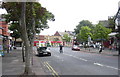
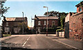
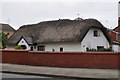
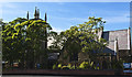

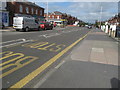
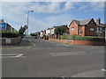
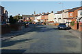
56 photos from this area
Area Information
Key information about the PR8 4BY including its size, population, and administrative classification.
- Area Type
- Postcode
- Area Size
- 9994 m²
- Population
- 1459
- Population Density
- 4745 people/km²
House Prices in PR8 4BY
18
Properties
£233,389
Average Sold Price
£80,000
Lowest Price
£416,000
Highest Price
Showing 18 properties
| Address | Type | Beds | Baths | Last Sale Price | Last Sale Date | |
|---|---|---|---|---|---|---|
| 15 St Peters Road, Birkdale, PR8 4BY | house | 3 | 1 | £300,000 | Nov 2024 | |
| 17 St Peters Road, Birkdale, PR8 4BY | house | - | - | £205,000 | Mar 2022 | |
| 19 St Peters Road, Birkdale, PR8 4BY | Detached | 4 | 1 | £416,000 | Mar 2022 | |
| 7 St Peters Road, Birkdale, PR8 4BY | Semi-detached | 3 | 1 | £202,500 | May 2018 | |
| 11 St Peters Road, Birkdale, PR8 4BY | house | - | - | £300,000 | Oct 2017 | |
| 6 St Peters Road, Birkdale, PR8 4BY | house | 5 | - | £249,999 | Jan 2014 | |
| 3 St Peters Road, Birkdale, PR8 4BY | house | 3 | 1 | £170,000 | Jul 2012 | |
| 2B St Peters Road, Birkdale, PR8 4BY | Semi-detached | - | - | £80,000 | Jun 2002 | |
| 4 St Peters Road, Birkdale, PR8 4BY | Detached | - | - | £177,000 | Feb 2001 | |
| 2A St Peters Road, Birkdale, PR8 4BY | Semi-detached | - | - | - | - |
Page 1 of 2
Energy Efficiency in PR8 4BY
Amenities
Schools
| Rank | School | Type | Entry gender | Ages |
|---|
Explore more schools in this area
Go to Schools tabDemographics
Household Size
One person
most common
Accommodation Type
Houses
most common
Tenure
70
majority
Ethnic Group
White
most common
Religion
N/A
most common
Household Composition
N/A
most common
Age
47
median
Adults (30-64 years)
most common
Household Deprivation
N/A
with no deprivation
NS-SEC
34
in Lower managerial occupations
Explore more demographic insights in this area
Go to Demographics tabPlanning
Planning Constraints
- Flood RiskPremium
- Ramsar Wetland SitesPremium
- Area of Outstanding Natural BeautyPremium
- Protected Nature ReservePremium
- Protected WoodlandPremium