Area Overview for PR8 4AB
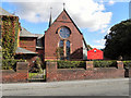
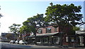
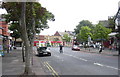
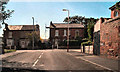
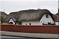
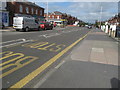
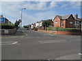
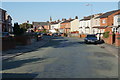
Photos of PR8 4AB


Area Information
Living in PR8 4AB offers a grounded experience within a small residential cluster in England. This specific postcode covers a population of 1,459 people, creating an intimate environment where neighbours know each other. The area is defined by its compact size and quiet residential character, making it suitable for those seeking a slower pace away from urban congestion. Residents enjoy a high degree of home ownership, which often translates to local stability and a settled community atmosphere. Daily life here revolves around proximity to key services without the noise and density of larger towns. You can expect a lifestyle where the distance to amenities is manageable by car or short walks to nearby rail stations. The setting avoids major planning constraints such as protected woodlands or nature reserves, allowing for straightforward life without complex regulatory overlays. Whether you are settling into this cluster for retirement or raising a family, the fundamental structure of the area remains consistent. This location provides a snapshot of typical residential England, focused on practical living rather than noisy entertainment or high-rise living. You will find a community that values stability, reflected in the high rate of people owning their own homes.
- Area Type
- Postcode
- Area Size
- Not available
- Population
- 1459
- Population Density
- 4745 people/km²
The property market in PR8 4AB is characterised by a dominant owner-occupier base. With 70% of residents owning their homes, this area functions primarily as a settled residential zone rather than a dynamic rental market. The accommodation type is strictly houses, meaning you will not find flats, bungalows, or high-rise apartments within this specific cluster. This homogeneity creates a predictable market where buyers often look for a traditional house purchase rather than a flat or leasehold arrangement. For those seeking PR8 4AB homes, the expectation should be a substantial property likely suited for families or retired ownership. The low percentage of rental stock suggests that landlords and investment portfolios play a minor role here compared to owner families. This makes the area attractive to families who plan to stay locally for many years. The lack of mixed housing types also means that the noise levels and structural design remain consistent throughout the estate. Buyers can anticipate a market driven by life-cycle events such as retirement or family expansion within a stable housing stock.
House Prices in PR8 4AB
No properties found in this postcode.
Energy Efficiency in PR8 4AB
Residents of PR8 4AB benefit from a practical range of amenities within easy reach. Your daily shopping needs are met by five local retail outlets, including Spar, Sainsburys Birkdale, and Morrisons Daily. These supermarkets provide one-stop convenience for groceries and household essentials without requiring a long drive into larger towns. For commuting, you have access to five rail connections via Birkdale Railway Station, Hillside Railway Station, and Southport Railway Station. These stations offer a straightforward link to wider travel networks, supporting your daily commute without reliance on private transport alone. The area is close to RAF Woodvale Airport, though this is a military installation rather than a commercial leisure destination. The combination of essential supermarkets and multiple rail hubs creates a functional lifestyle where work and home life are well-connected. You can shop for fresh food in the morning and catch a train to the city in the afternoon using the facilities nearby.
Amenities
Schools
Families considering PR8 4AB will find St Teresa's Catholic Infant and Nursery School nearby. This is the only school currently listed for this immediate vicinity, operating as a primary institution where children start their education. The presence of a nursery provision alongside an infant school indicates support for the youngest children in the community. While no secondary schools appear in the immediate list for this postcode, primary education is covered directly by this facility. You are looking at a scenario where early childhood education is available without needing to travel far. The single-school configuration for this primary step suggests a focused environment for young learners in PR8 4AB. Parents of infant and nursery age children have a designated local option for their daily schooling needs.
| Rank | School | Type | Entry gender | Ages |
|---|
Explore more schools in this area
Go to Schools tabDemographics
The community in PR8 4AB is defined by a mature demographic profile, with a median age of 47 years. The most common age range involves adults between 30 and 64 years old, indicating a neighbourhood dominated by working-age families and individuals in their middle years. A significant 70% of residents are homeowners, meaning this is an area where long-term settlement is the norm rather than the exception for visitors or short-term renters. The housing stock consists exclusively of houses, catering specifically to family life and established households rather than flat living. The predominant ethnic group in PR8 4AB is White, reflecting a community with a specific cultural history rooted in local heritage. These figures paint a clear picture of a stable, owner-occupied district where families have planted themselves for the long term. The absence of a significant young professional demographic or student population distinguishes this place from many modern university towns. Instead, you encounter a neighbourhood built around established routines and long-term local commitments.
Household Size
Accommodation Type
Tenure
Ethnic Group
Religion
Household Composition
Age
Household Deprivation
NS-SEC
Explore more demographic insights in this area
Go to Demographics tabPlanning
Planning Constraints
- Flood RiskPremium
- Ramsar Wetland SitesPremium
- Area of Outstanding Natural BeautyPremium
- Protected Nature ReservePremium
- Protected WoodlandPremium