Area Overview for PR8 3NR
Photos of PR8 3NR
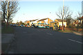
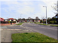
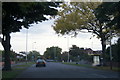
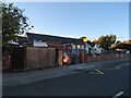
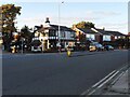
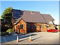
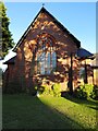

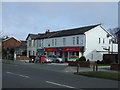
16 photos from this area
Area Information
Key information about the PR8 3NR including its size, population, and administrative classification.
- Area Type
- Postcode
- Area Size
- 1.5 hectares
- Population
- 1611
- Population Density
- 3954 people/km²
House Prices in PR8 3NR
28
Properties
£309,050
Average Sold Price
£33,500
Lowest Price
£725,000
Highest Price
Showing 28 properties
| Address | Type | Beds | Baths | Last Sale Price | Last Sale Date | |
|---|---|---|---|---|---|---|
| 647 Liverpool Road, Ainsdale, PR8 3NR | Semi-detached | 4 | 2 | £400,000 | Feb 2025 | |
| 641 Liverpool Road, Ainsdale, PR8 3NR | Detached | 4 | 3 | £725,000 | Jan 2025 | |
| 659 Liverpool Road, Ainsdale, PR8 3NR | Semi-detached | 5 | 2 | £442,500 | Aug 2024 | |
| 661 Liverpool Road, Ainsdale, PR8 3NR | house | - | - | £385,000 | Oct 2021 | |
| 639 Liverpool Road, Ainsdale, PR8 3NR | house | - | - | £293,000 | Mar 2017 | |
| 655 Liverpool Road, Ainsdale, PR8 3NR | house | - | - | £299,950 | Nov 2004 | |
| 673A Liverpool Road, Ainsdale, PR8 3NR | Flat | - | - | £33,500 | Oct 2000 | |
| 649 Liverpool Road, Ainsdale, PR8 3NR | Detached | - | - | £113,500 | Aug 2000 | |
| 637 Liverpool Road, Ainsdale, PR8 3NR | house | - | - | £89,000 | Feb 1996 | |
| First Floor Flat, 675 Liverpool Road, Ainsdale, PR8 3NR | Flat | - | - | - | - |
Page 1 of 3
Energy Efficiency in PR8 3NR
Amenities
Schools
| Rank | School | Type | Entry gender | Ages |
|---|
Explore more schools in this area
Go to Schools tabDemographics
Household Size
Two person
most common
Accommodation Type
Houses
most common
Tenure
75
majority
Ethnic Group
White
most common
Religion
N/A
most common
Household Composition
N/A
most common
Age
47
median
Adults (30-64 years)
most common
Household Deprivation
N/A
with no deprivation
NS-SEC
35
in Lower managerial occupations
Explore more demographic insights in this area
Go to Demographics tabPlanning
Planning Constraints
- Flood RiskPremium
- Ramsar Wetland SitesPremium
- Area of Outstanding Natural BeautyPremium
- Protected Nature ReservePremium
- Protected WoodlandPremium