Area Overview for PR8 2HX
Photos of PR8 2HX
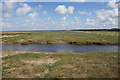
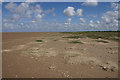
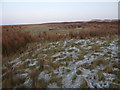
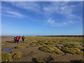
10 photos from this area
Area Information
Key information about the PR8 2HX including its size, population, and administrative classification.
- Area Type
- Postcode
- Area Size
- 1.5 km²
- Population
- 1605
- Population Density
- 432 people/km²
House Prices in PR8 2HX
12
Properties
£867,857
Average Sold Price
£470,000
Lowest Price
£1,500,000
Highest Price
Showing 12 properties
| Address | Type | Beds | Baths | Last Sale Price | Last Sale Date | |
|---|---|---|---|---|---|---|
| 52 Selworthy Road, Birkdale, PR8 2HX | house | - | - | £750,000 | May 2021 | |
| 53 Selworthy Road, Birkdale, PR8 2HX | Detached | 5 | - | £925,000 | Dec 2019 | |
| 57 Selworthy Road, Birkdale, PR8 2HX | house | 4 | 4 | £1,500,000 | Apr 2019 | |
| 48 Selworthy Road, Birkdale, PR8 2HX | house | - | - | £630,000 | Mar 2017 | |
| 51 Selworthy Road, Birkdale, PR8 2HX | Detached | 4 | 4 | £700,000 | Aug 2015 | |
| 63 Selworthy Road, Birkdale, PR8 2HX | Detached | - | - | £1,100,000 | Mar 2005 | |
| 50 Selworthy Road, Birkdale, PR8 2HX | Detached | - | - | £470,000 | Dec 2003 | |
| Royal Birkdale Golf Links, Selworthy Road, Birkdale, PR8 2HX | Leisure | - | - | - | - | |
| 55 Selworthy Road, Birkdale, PR8 2HX | house | - | - | - | - | |
| 46 Selworthy Road, Birkdale, PR8 2HX | house | - | - | - | - |
Page 1 of 2
Energy Efficiency in PR8 2HX
Amenities
Schools
| Rank | School | Type | Entry gender | Ages |
|---|
Explore more schools in this area
Go to Schools tabDemographics
Household Size
One person
most common
Accommodation Type
Flats
most common
Tenure
68
majority
Ethnic Group
White
most common
Religion
N/A
most common
Household Composition
N/A
most common
Age
47
median
Elderly (65+ years)
most common
Household Deprivation
N/A
with no deprivation
NS-SEC
40
in Lower managerial occupations
Explore more demographic insights in this area
Go to Demographics tabPlanning
Planning Constraints
- Flood RiskPremium
- Ramsar Wetland SitesPremium
- Area of Outstanding Natural BeautyPremium
- Protected Nature ReservePremium
- Protected WoodlandPremium