Area Overview for PR8 2DD
Photos of PR8 2DD

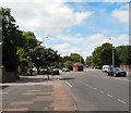
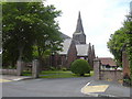

84 photos from this area
Area Information
Key information about the PR8 2DD including its size, population, and administrative classification.
- Area Type
- Postcode
- Area Size
- 1.5 hectares
- Population
- 1559
- Population Density
- 1639 people/km²
House Prices in PR8 2DD
22
Properties
£297,400
Average Sold Price
£240,000
Lowest Price
£410,000
Highest Price
Showing 22 properties
| Address | Type | Beds | Baths | Last Sale Price | Last Sale Date | |
|---|---|---|---|---|---|---|
| 20 Ascot Close, Birkdale, PR8 2DD | Detached | 3 | 1 | £410,000 | Jul 2024 | |
| 14 Ascot Close, Birkdale, PR8 2DD | house | - | - | £395,000 | Apr 2022 | |
| 23 Ascot Close, Birkdale, PR8 2DD | house | - | - | £321,000 | Apr 2021 | |
| 7 Ascot Close, Birkdale, PR8 2DD | Detached | 3 | 1 | £275,000 | Aug 2019 | |
| 12 Ascot Close, Birkdale, PR8 2DD | house | - | - | £262,000 | Jul 2019 | |
| 22 Ascot Close, Birkdale, PR8 2DD | Detached | 3 | 1 | £347,500 | Jan 2019 | |
| 6 Ascot Close, Birkdale, PR8 2DD | Detached | 3 | 1 | £267,500 | Feb 2018 | |
| 11 Ascot Close, Birkdale, PR8 2DD | Bungalow | - | - | £240,000 | Feb 2012 | |
| 16 Ascot Close, Birkdale, PR8 2DD | Detached | - | - | £265,000 | Oct 2009 | |
| 4 Ascot Close, Birkdale, PR8 2DD | Bungalow | - | - | £250,000 | Oct 2009 |
Page 1 of 3
Energy Efficiency in PR8 2DD
Amenities
Schools
| Rank | School | Type | Entry gender | Ages |
|---|
Explore more schools in this area
Go to Schools tabDemographics
Household Size
Two person
most common
Accommodation Type
Flats
most common
Tenure
78
majority
Ethnic Group
White
most common
Religion
N/A
most common
Household Composition
N/A
most common
Age
47
median
Elderly (65+ years)
most common
Household Deprivation
N/A
with no deprivation
NS-SEC
43
in Lower managerial occupations
Explore more demographic insights in this area
Go to Demographics tabPlanning
Planning Constraints
- Flood RiskPremium
- Ramsar Wetland SitesPremium
- Area of Outstanding Natural BeautyPremium
- Protected Nature ReservePremium
- Protected WoodlandPremium