Area Overview for PR7 7HJ
Photos of PR7 7HJ
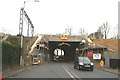
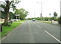
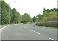
![50 mile speed limit, Wigan Road [A49] in PR7 7HJ](https://images.propbar.co.uk/images/geograph/20/09/2009297_120.jpg)
18 photos from this area
Area Information
Key information about the PR7 7HJ including its size, population, and administrative classification.
- Area Type
- Postcode
- Area Size
- 2.5 hectares
- Population
- 1482
- Population Density
- 1067 people/km²
House Prices in PR7 7HJ
42
Properties
£272,739
Average Sold Price
£75,000
Lowest Price
£401,000
Highest Price
Showing 42 properties
| Address | Type | Beds | Baths | Last Sale Price | Last Sale Date | |
|---|---|---|---|---|---|---|
| 31 Dunnerholme Avenue, Buckshaw Village, PR7 7HJ | Detached | 4 | 3 | £401,000 | Oct 2025 | |
| 9 Dunnerholme Avenue, Buckshaw Village, PR7 7HJ | Detached | 4 | 2 | £320,000 | May 2021 | |
| 37 Dunnerholme Avenue, Buckshaw Village, PR7 7HJ | Detached | 4 | 1 | £284,000 | Apr 2021 | |
| 6 Dunnerholme Avenue, Buckshaw Village, PR7 7HJ | house | - | - | £320,000 | Jan 2021 | |
| 8 Dunnerholme Avenue, Buckshaw Village, PR7 7HJ | Detached | 4 | 3 | £315,000 | Nov 2020 | |
| 29 Dunnerholme Avenue, Buckshaw Village, PR7 7HJ | Detached | 4 | 2 | £237,000 | Sep 2020 | |
| 14 Dunnerholme Avenue, Buckshaw Village, PR7 7HJ | house | 3 | - | £75,000 | Sep 2020 | |
| 23 Dunnerholme Avenue, Buckshaw Village, PR7 7HJ | Detached | 4 | 3 | £283,000 | Dec 2019 | |
| 45 Dunnerholme Avenue, Buckshaw Village, PR7 7HJ | Detached | 3 | 2 | £225,000 | Feb 2019 | |
| 4 Dunnerholme Avenue, Buckshaw Village, PR7 7HJ | Detached | 4 | 4 | £295,000 | Jul 2018 |
Page 1 of 5
Energy Efficiency in PR7 7HJ
Amenities
Schools
| Rank | School | Type | Entry gender | Ages |
|---|
Explore more schools in this area
Go to Schools tabDemographics
Household Size
Family (3-5 people)
most common
Accommodation Type
Houses
most common
Tenure
76
majority
Ethnic Group
White
most common
Religion
N/A
most common
Household Composition
N/A
most common
Age
47
median
Adults (30-64 years)
most common
Household Deprivation
N/A
with no deprivation
NS-SEC
45
in Lower managerial occupations
Explore more demographic insights in this area
Go to Demographics tabPlanning
Planning Constraints
- Flood RiskPremium
- Ramsar Wetland SitesPremium
- Area of Outstanding Natural BeautyPremium
- Protected Nature ReservePremium
- Protected WoodlandPremium