Area Overview for PR7 6NX
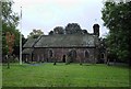
Photos of PR7 6NX
![Wigan Road, Euxton [A49] approaching a roundabout in PR7 6NX](https://images.propbar.co.uk/images/geograph/20/38/2038536_120.jpg)

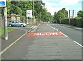
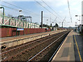
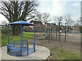
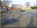

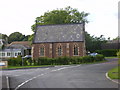
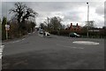
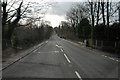
37 photos from this area
Area Information
Key information about the PR7 6NX including its size, population, and administrative classification.
- Area Type
- Postcode
- Area Size
- 4251 m²
- Population
- 1348
- Population Density
- 2369 people/km²
House Prices in PR7 6NX
12
Properties
£152,864
Average Sold Price
£58,000
Lowest Price
£321,600
Highest Price
Showing 12 properties
| Address | Type | Beds | Baths | Last Sale Price | Last Sale Date | |
|---|---|---|---|---|---|---|
| 11 Ambleside Avenue, Euxton, PR7 6NX | Semi-detached | 4 | 3 | £321,600 | Jan 2023 | |
| 8 Ambleside Avenue, Euxton, PR7 6NX | house | - | - | £110,000 | Oct 2018 | |
| 6 Ambleside Avenue, Euxton, PR7 6NX | house | - | - | £150,000 | Jun 2016 | |
| 12 Ambleside Avenue, Euxton, PR7 6NX | house | - | - | £142,500 | Oct 2014 | |
| 4 Ambleside Avenue, Euxton, PR7 6NX | Semi-detached | 4 | 2 | £158,000 | Feb 2007 | |
| 7 Ambleside Avenue, Euxton, PR7 6NX | Semi-detached | - | - | £129,950 | Sep 2004 | |
| 9 Ambleside Avenue, Euxton, PR7 6NX | Semi-detached | - | - | £58,000 | Nov 1995 | |
| 10 Ambleside Avenue, Euxton, PR7 6NX | Semi-detached | 2 | 1 | - | - | |
| 2 Ambleside Avenue, Euxton, PR7 6NX | Semi-detached | 4 | 2 | - | - | |
| 3 Ambleside Avenue, Euxton, PR7 6NX | house | - | - | - | - |
Page 1 of 2
Energy Efficiency in PR7 6NX
Amenities
Schools
| Rank | School | Type | Entry gender | Ages |
|---|
Explore more schools in this area
Go to Schools tabDemographics
Household Size
Two person
most common
Accommodation Type
Houses
most common
Tenure
91
majority
Ethnic Group
White
most common
Religion
N/A
most common
Household Composition
N/A
most common
Age
47
median
Adults (30-64 years)
most common
Household Deprivation
N/A
with no deprivation
NS-SEC
38
in Lower managerial occupations
Explore more demographic insights in this area
Go to Demographics tabPlanning
Planning Constraints
- Flood RiskPremium
- Ramsar Wetland SitesPremium
- Area of Outstanding Natural BeautyPremium
- Protected Nature ReservePremium
- Protected WoodlandPremium