Area Overview for PR7 6JZ
Photos of PR7 6JZ
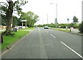
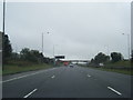
![50 mile speed limit, Wigan Road [A49] in PR7 6JZ](https://images.propbar.co.uk/images/geograph/20/09/2009297_120.jpg)
Area Information
Living in PR7 6JZ offers a settled residential experience defined by high density within a defined boundary. This specific postcode covers 21.6 hectares and accommodates 1,812 residents. The result is a compact neighbourhood where inhabitants share immediate proximity to one another. Population density reaches 8,371 people per square kilometre, creating a closely knit environment typical of established suburban clusters in the North West. You will find this area is not sprawling; it is a focused residential zone where daily commutes involve short distances and local interaction is frequent. The character of PR7 6JZ is one of stability and exclusivity due to its small scale. Prospective buyers looking for a defined community with clear boundaries will recognise this layout as suitable for those who value familiarity over vast open spaces. The environment is strictly residential in nature, meaning you navigate streets designed for habitation rather than commerce or industry. This concentration ensures that the majority of your surroundings consist of fellow neighbours. You are part of a tight-knit group within the broader region, where the physical layout reinforces social connections. The specific cluster nature of this postcode means you benefit from shared local knowledge without the anonymity of larger urban settings.
- Area Type
- Postcode
- Area Size
- 21.6 hectares
- Population
- 1812
- Population Density
- 2131 people/km²
The property market in PR7 6JZ is almost entirely characterised by private homeownership rather than rental investments. You will find that 96 per cent of the area consists of owner-occupied households. This statistic effectively rules out a significant sector of long-term private renting within this specific postcode. The housing stock is comprised of houses, meaning you will encounter detached, semi-detached, or terraced homes rather than purpose-built flats or student accommodation. This composition suits buyers looking for traditional family housing with gardens and private entrances. For those seeking a rental yield, this area offers limited opportunity due to the lack of available rental units in the immediate cluster. Instead, the market appeals to people moving into the locality to settle down. The consistency of house predominance means that planning your search around house types will yield accurate results. You can expect a market where sales reflect life changes, relocations, or upgrades rather than turning over units to tenants. The small size of the 21.6-hectare area further limits inventory, making each property sale a significant event for the local market dynamics.
House Prices in PR7 6JZ
Showing 5 properties
| Address | Type | Beds | Baths | Last Sale Price | Last Sale Date | |
|---|---|---|---|---|---|---|
| Pack Saddle Barn, Wigan Road, Euxton, PR7 6JZ | Detached | - | - | £720,000 | May 2007 | |
| Atherton House, Wigan Road, Euxton, PR7 6JZ | Detached | - | - | £350,000 | Dec 2003 | |
| Pack Saddle Farm, Wigan Road, Euxton, PR7 6JZ | Detached | - | - | £150,000 | May 2001 | |
| The Bungalow, 38 Wigan Road, Euxton, PR7 6JZ | Detached | 4 | - | - | - | |
| Buckshaw Motors, The Bungalow, 38 Wigan Road, Euxton, PR7 6JZ | commercial | - | - | - | - |
Energy Efficiency in PR7 6JZ
Your daily routine in PR7 6JZ is supported by a compact cluster of retail and transport hubs. Five shops are located within immediate reach, including Spar outlets and Tesco Leyland. You can shop for groceries and essential goods without the need for long journeys to larger town centres. These retailers cater to the needs of the 1,812 residents living in the small residential cluster. Transport links also sit close by, with five nearby railway stations providing commuter access. Notable stops include Buckshaw Parkway Railway Station, Leyland Railway Station, and Euxton Balshaw Lane Railway Station. These stations offer connections to wider parts of the region. While there is no data provided on parks or leisure centres, the proximity of these key amenities creates a convenient lifestyle. You do not need to travel far to purchase food or use public transport. The integration of Spar, Tesco, and railway stations within the dwelling area simplifies errands. Living in PR7 6JZ means you have your essential services in the immediate vicinity, reducing reliance on cars for daily tasks.
Amenities
Schools
Families living in PR7 6JZ have access to a primary education option that holds a positive regulatory rating. The nearest established institution is Balshaw's Church of England High School, which carries an Ofsted rating of good. Although the name implies secondary provision, this facility serves the immediate educational needs of the local catchment area according to the provided records. The presence of a school with a good rating offers reassurance regarding educational standards for children residing in the postcode. You will find no secondary data listed for other schools in the immediate vicinity, so parents rely on this single specific provider for local education. The mix of school types in the data focuses strictly on primary education under this name. This suggests a consistent educational approach rooted in the Church of England traditions. When planning your move, you can confirm that a school with a verified good rating exists within practical reach. The availability of this institution supports the family-focused nature of the 1,812-person community. You do not need to search far for education options, as this specific school forms the core of the local provision.
| Rank | School | Type | Entry gender | Ages |
|---|
Explore more schools in this area
Go to Schools tabDemographics
The community profile in PR7 6JZ reflects a mature, stable population with distinct housing patterns. Your neighbours are predominantly adults aged between 30 and 64 years, and the median age across the area is 47. This age range suggests a population that has secured their careers and homes, seeking long-term stability rather than transient living arrangements. House ownership stands at 96 per cent, indicating that nearly every resident lives in a property they own outright or own with a mortgage. This high rate implies a community driven by owner-occupiers who have a vested interest in the local market stability. The accommodation type is exclusively houses, confirming that this postcode does not contain flats, apartments, or converted accommodation. This homogeneity creates a uniform streetscape where you live adjacent to similar structures and architectural styles. The ethnic composition is predominantly White, reflecting a traditional demographic makeup common in many parts of the Lancashire region. You will find a homogenous group of residents who share similar life stages and housing priorities. Deprivation indicators are not highlighted in the available figures, allowing you to focus on the clear evidence of a wealthy, established ownership community.
Household Size
Accommodation Type
Tenure
Ethnic Group
Religion
Household Composition
Age
Household Deprivation
NS-SEC
Explore more demographic insights in this area
Go to Demographics tabPlanning
Planning Constraints
- Flood RiskPremium
- Ramsar Wetland SitesPremium
- Area of Outstanding Natural BeautyPremium
- Protected Nature ReservePremium
- Protected WoodlandPremium