Area Overview for PR7 6DR
Photos of PR7 6DR
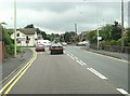
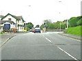
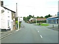
![Wigan Road, Euxton [A49] in PR7 6DR](https://images.propbar.co.uk/images/geograph/20/09/2009288_120.jpg)
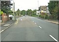
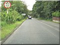
![Junction of Runshaw Lane and Wigan Road [A49] in PR7 6DR](https://images.propbar.co.uk/images/geograph/20/67/2067559_120.jpg)

44 photos from this area
Area Information
Key information about the PR7 6DR including its size, population, and administrative classification.
- Area Type
- Postcode
- Area Size
- 4191 m²
- Population
- 2194
- Population Density
- 3513 people/km²
House Prices in PR7 6DR
3
Properties
£210,000
Average Sold Price
£210,000
Lowest Price
£210,000
Highest Price
Showing 3 properties
| Address | Type | Beds | Baths | Last Sale Price | Last Sale Date | |
|---|---|---|---|---|---|---|
| 89 Euxton Lane, Euxton, PR7 6DR | house | - | - | £210,000 | Aug 2007 | |
| Caravan, 89 Euxton Lane, Euxton, PR7 6DR | Mobile Home | - | - | - | - | |
| Knowe House, Euxton Lane, Euxton, PR7 6DR | Detached | - | - | - | - |
Energy Efficiency in PR7 6DR
Amenities
Schools
| Rank | School | Type | Entry gender | Ages |
|---|
Explore more schools in this area
Go to Schools tabDemographics
Household Size
Family (3-5 people)
most common
Accommodation Type
Houses
most common
Tenure
88
majority
Ethnic Group
White
most common
Religion
N/A
most common
Household Composition
N/A
most common
Age
47
median
Adults (30-64 years)
most common
Household Deprivation
N/A
with no deprivation
NS-SEC
48
in Lower managerial occupations
Explore more demographic insights in this area
Go to Demographics tabPlanning
Planning Constraints
- Flood RiskPremium
- Ramsar Wetland SitesPremium
- Area of Outstanding Natural BeautyPremium
- Protected Nature ReservePremium
- Protected WoodlandPremium