Area Overview for PR7 4HF
Photos of PR7 4HF
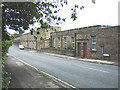
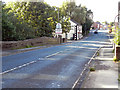
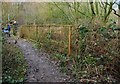
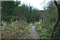
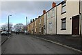
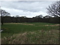
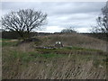
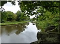
33 photos from this area
Area Information
Key information about the PR7 4HF including its size, population, and administrative classification.
- Area Type
- Postcode
- Area Size
- 1.7 hectares
- Population
- 1727
- Population Density
- 2547 people/km²
House Prices in PR7 4HF
15
Properties
£89,200
Average Sold Price
£31,600
Lowest Price
£160,000
Highest Price
Showing 15 properties
| Address | Type | Beds | Baths | Last Sale Price | Last Sale Date | |
|---|---|---|---|---|---|---|
| 72 Market Street, Adlington, PR7 4HF | Terraced | 2 | 1 | £85,000 | Sep 2025 | |
| 76 Market Street, Adlington, PR7 4HF | house | - | - | £160,000 | Jul 2025 | |
| 36 Market Street, Adlington, PR7 4HF | Terraced | 2 | 1 | £54,000 | Dec 2019 | |
| 58 Market Street, Adlington, PR7 4HF | Terraced | 3 | 1 | £116,000 | May 2019 | |
| 68 Market Street, Adlington, PR7 4HF | Semi-detached | 2 | 1 | £80,000 | Jun 2010 | |
| 56 Market Street, Adlington, PR7 4HF | Terraced | 3 | 1 | £94,000 | Apr 2005 | |
| 70 Market Street, Adlington, PR7 4HF | Semi-detached | 2 | 1 | £93,000 | Sep 2004 | |
| 50 Market Street, Adlington, PR7 4HF | Terraced | - | - | £31,600 | Feb 1997 | |
| 74 Market Street, Adlington, PR7 4HF | Terraced | 2 | 1 | - | - | |
| 46 Market Street, Adlington, PR7 4HF | Retail | - | - | - | - |
Page 1 of 2
Energy Efficiency in PR7 4HF
Amenities
Schools
| Rank | School | Type | Entry gender | Ages |
|---|
Explore more schools in this area
Go to Schools tabDemographics
Household Size
One person
most common
Accommodation Type
Houses
most common
Tenure
63
majority
Ethnic Group
White
most common
Religion
N/A
most common
Household Composition
N/A
most common
Age
47
median
Adults (30-64 years)
most common
Household Deprivation
N/A
with no deprivation
NS-SEC
26
in Lower managerial occupations
Explore more demographic insights in this area
Go to Demographics tabPlanning
Planning Constraints
- Flood RiskPremium
- Ramsar Wetland SitesPremium
- Area of Outstanding Natural BeautyPremium
- Protected Nature ReservePremium
- Protected WoodlandPremium