Area Overview for PR7 3PF
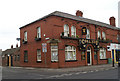
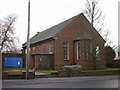
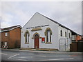
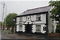
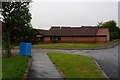
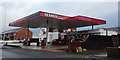
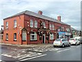
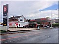
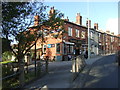
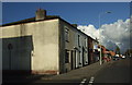
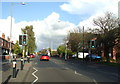
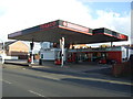
Photos of PR7 3PF
Area Information
Living in PR7 3PF means residing in a very specific postcode area that covers a small residential cluster of just 1.8 hectares. This compact size concentrates 2,198 people into a tightly knit environment, creating a density of 121,155 people per square kilometre. Such high density defines the daily reality for residents, who navigate a space where neighbours are naturally closer together. The area is located in England and functions as a distinct pocket within the wider regional landscape. You will find that life here revolves around this concentrated footprint rather than sprawling expanses. The sheer number of homes packed into such a small land area creates a sense of immediacy that is uncommon in other parts of the country. Prospective buyers should understand that PR7 3PF is not about large gardens or isolated streets but about the intensity of a community packed into a limited geographical zone. This residential cluster forms the core of your living experience, shaping everything from noise levels to commutes. Understanding this physical layout helps you gauge whether this specific density aligns with your lifestyle needs.
- Area Type
- Postcode
- Area Size
- 1.8 hectares
- Population
- 2198
- Population Density
- 2256 people/km²
Homes in PR7 3PF are exclusively houses, meaning you will not find apartments or purpose-built flats within this specific postcode. The accommodation type is uniform across the entire 1.8-hectare cluster. House ownership dominates the market with an 87% ownership rate, which is significantly higher than the national average. This statistic confirms that PR7 3PF is overwhelmingly an owner-occupied area rather than a rental hub. Potential buyers should expect to purchase a family home or keep existing properties rather than looking for buy-to-let opportunities. The high concentration of owned homes suggests a market driven by long-term residents seeking stability. There are no data points provided regarding current sale prices, rental yields, or recent property transaction volumes. Consequently, the market picture relies on the structural facts of house type and ownership levels. This environment appeals to those who can afford to buy and plan to stay for the long term. The lack of rental units further reduces competition for sellers compared to mixed-use areas.
House Prices in PR7 3PF
Showing 21 properties
| Address | Type | Beds | Baths | Last Sale Price | Last Sale Date | |
|---|---|---|---|---|---|---|
| 95 Eaves Green Road, Chorley, PR7 3PF | Terraced | 3 | 1 | £117,500 | Feb 2023 | |
| 113 Eaves Green Road, Chorley, PR7 3PF | house | - | - | £105,000 | May 2022 | |
| 93 Eaves Green Road, Chorley, PR7 3PF | house | - | - | £80,000 | Jun 2014 | |
| 91 Eaves Green Road, Chorley, PR7 3PF | Terraced | - | - | £54,400 | Jul 2006 | |
| 109 Eaves Green Road, Chorley, PR7 3PF | Terraced | - | - | £63,750 | Sep 2005 | |
| 115 Eaves Green Road, Chorley, PR7 3PF | Terraced | - | - | £29,950 | May 1997 | |
| 99 Eaves Green Road, Chorley, PR7 3PF | Terraced | 3 | 1 | - | - | |
| 81 Eaves Green Road, Chorley, PR7 3PF | Terraced | - | - | - | - | |
| 87 Eaves Green Road, Chorley, PR7 3PF | Terraced | - | - | - | - | |
| 103 Eaves Green Road, Chorley, PR7 3PF | house | - | - | - | - |
Energy Efficiency in PR7 3PF
Residents in PR7 3PF have direct access to significant retail and transport hubs within practical reach, despite the small size of the postcode itself. You can travel to Asda Chorley, Heron Chorley, and another Asda location for all your shopping requirements. These three major retailers are listed as the notable amenities in the nearby retail category, offering a complete range of daily goods. For commuters, travel options include Chorley Railway Station, Euxton Balshaw Lane Railway Station, and Adlington Railway Station. Having three distinct railway stations nearby provides multiple choices for your daily journey to work or leisure trips. This proximity to major stations like Chorley means you do not need to drive far to access the wider transport network. The availability of these specific venues ensures that your daily routine involves minimal travel time to essential services. Living in PR7 3PF grants you immediate access to these established Commercial and transport nodes.
Amenities
Schools
| Rank | School | Type | Entry gender | Ages |
|---|
Explore more schools in this area
Go to Schools tabDemographics
The community in PR7 3PF is dominated by adults aged between 30 and 64 years, reflecting a mature and established population. The median age stands at 47, which suggests most residents have families or are nearing retirement. This age profile creates a stable environment where long-term stability takes precedence over transient trends. Home ownership rates are exceptionally high at 87%, indicating that the vast majority of households own their property outright or have a mortgage. This contrasts sharply with areas where renting is the norm, as it implies residents are deeply invested in their local location. The predominant ethnic group is White, making this a culturally homogeneous neighbourhood. All accommodation in PR7 3PF consists of houses, removing flats and apartments from the equation. This structure supports the high ownership rate and the age demographic. There is no data provided on deprivation indices, so any assessment of quality of life relies on the visible stability of the housing stock and age distribution. The demographic make-up signals a district where people put down roots and build lives over many years.
Household Size
Accommodation Type
Tenure
Ethnic Group
Religion
Household Composition
Age
Household Deprivation
NS-SEC
Explore more demographic insights in this area
Go to Demographics tabPlanning
Planning Constraints
- Flood RiskPremium
- Ramsar Wetland SitesPremium
- Area of Outstanding Natural BeautyPremium
- Protected Nature ReservePremium
- Protected WoodlandPremium