Area Overview for PR7 2NL
Photos of PR7 2NL
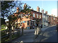
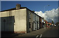
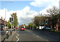
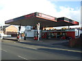
26 photos from this area
Area Information
Key information about the PR7 2NL including its size, population, and administrative classification.
- Area Type
- Postcode
- Area Size
- 9.1 hectares
- Population
- 2377
- Population Density
- 2103 people/km²
House Prices in PR7 2NL
68
Properties
£197,943
Average Sold Price
£24,549
Lowest Price
£600,000
Highest Price
Showing 68 properties
| Address | Type | Beds | Baths | Last Sale Price | Last Sale Date | |
|---|---|---|---|---|---|---|
| 24 Clover Road, Chorley, PR7 2NL | Terraced | 3 | 1 | £122,500 | Oct 2021 | |
| Valley View, Clover Road, Chorley, PR7 2NL | Detached | 5 | 3 | £600,000 | May 2019 | |
| 10 Clover Road, Chorley, PR7 2NL | house | 2 | - | £129,995 | Jul 2018 | |
| 30 Clover Road, Chorley, PR7 2NL | Terraced | 2 | 1 | £104,500 | Jul 2017 | |
| 26 Clover Road, Chorley, PR7 2NL | Terraced | 3 | 1 | £86,000 | Mar 2014 | |
| Higher Kingsley, Clover Road, Chorley, PR7 2NL | house | - | - | £340,000 | Dec 2004 | |
| 32 Clover Road, Chorley, PR7 2NL | Bungalow | - | - | £24,549 | Sep 2004 | |
| Harley House, Clover Road, Chorley, PR7 2NL | Detached | - | - | £176,000 | Oct 2003 | |
| Pondorosa, 2 Clover Road, Chorley, PR7 2NL | Bungalow | 5 | 1 | - | - | |
| Garage, Grundys Farm, Clover Road, Chorley, PR7 2NL | warehouse | - | - | - | - |
Page 1 of 7
Energy Efficiency in PR7 2NL
Amenities
Schools
| Rank | School | Type | Entry gender | Ages |
|---|
Explore more schools in this area
Go to Schools tabDemographics
Household Size
Two person
most common
Accommodation Type
Houses
most common
Tenure
54
majority
Ethnic Group
White
most common
Religion
N/A
most common
Household Composition
N/A
most common
Age
47
median
Adults (30-64 years)
most common
Household Deprivation
N/A
with no deprivation
NS-SEC
25
in Lower managerial occupations
Explore more demographic insights in this area
Go to Demographics tabPlanning
Planning Constraints
- Flood RiskPremium
- Ramsar Wetland SitesPremium
- Area of Outstanding Natural BeautyPremium
- Protected Nature ReservePremium
- Protected WoodlandPremium