Area Overview for PR7 2FG
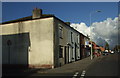
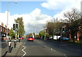
Photos of PR7 2FG


Area Information
PR7 2FG represents a specific postcode cluster within the Chorley district of Lancashire, England. This residential pocket covers an area of 2.8 hectares and supports a population of 1723 people. The high population density of 61,121 people per square kilometre indicates a closely knit neighbourhood where properties are situated relatively close together. Living in PR7 2FG means residing within a defined geographic boundary that functions as a distinct residential unit rather than a sprawling suburb. The location is characterised by its compact nature, which fosters a sense of locality while maintaining proximity to wider transport networks. Residents here experience daily life within a concentrated community setting. The area serves as a practical base for commuters accessing Chorley and surrounding towns. Homebuyers considering this postcode find a settled environment defined by its specific boundaries and resident count. It offers a straightforward address for those seeking a home in this postcode sector without the confusion of larger, ill-defined zones. The 2.8-hectare footprint ensures that the community remains accessible and walkable for local activities.
- Area Type
- Postcode
- Area Size
- 2.8 hectares
- Population
- 1723
- Population Density
- 4487 people/km²
The property market in PR7 2FG is defined by a substantial home ownership rate of 65 per cent. This figure indicates that the vast majority of residents own their freehold or leasehold properties outright or with a mortgage. Houses constitute the main accommodation type within this postcode, which typically appeals to buyers seeking permanent residences rather than flat-level living. The dominance of owner-occupied homes suggests a market driven by people moving due to life events rather than investors flipping properties. Homes in PR7 2FG cater primarily to families or individuals requiring standalone dwelling options. For those looking to buy, the environment resembles a standard local market where owners are selling from their own portfolios. The 65 per cent ownership statistic means rental yields may be lower than in high-flip investment zones, but security of tenure is higher. Buyers interested in this area should expect to engage with existing owners rather than landowners or large corporate landlords. The presence of standard houses aligns with the older median age of 47, indicating a preference for established architecture over new-build estates.
House Prices in PR7 2FG
Showing 38 properties
| Address | Type | Beds | Baths | Last Sale Price | Last Sale Date | |
|---|---|---|---|---|---|---|
| 12 Nab Wood Drive, Chorley, PR7 2FG | Detached | 4 | 2 | £327,000 | Jun 2025 | |
| 38 Nab Wood Drive, Chorley, PR7 2FG | Detached | 4 | 3 | £327,250 | Sep 2023 | |
| 26 Nab Wood Drive, Chorley, PR7 2FG | Detached | 3 | 2 | £244,000 | Jul 2023 | |
| 39 Nab Wood Drive, Chorley, PR7 2FG | Detached | 4 | 3 | £347,000 | Jul 2022 | |
| 29 Nab Wood Drive, Chorley, PR7 2FG | house | - | - | £268,500 | Mar 2021 | |
| 22 Nab Wood Drive, Chorley, PR7 2FG | Detached | 4 | 3 | £341,000 | Nov 2020 | |
| 33 Nab Wood Drive, Chorley, PR7 2FG | Detached | 4 | 2 | £250,000 | Sep 2020 | |
| 23 Nab Wood Drive, Chorley, PR7 2FG | Detached | 4 | 2 | £240,000 | Oct 2019 | |
| 35 Nab Wood Drive, Chorley, PR7 2FG | Detached | 4 | 2 | £222,500 | Apr 2019 | |
| 11 Nab Wood Drive, Chorley, PR7 2FG | Detached | 4 | 2 | £250,000 | Mar 2019 |
Energy Efficiency in PR7 2FG
Residents of PR7 2FG enjoy convenient access to major retail and transport hubs located just outside their immediate neighbourhood. The nearest retail outlets include Heron Chorley, Asda Chorley, and Tesco Chorley, all of which fall within practical reach. This selection ensures that daily shopping, grocery runs, and household needs are met without requiring lengthy travel. For transport, the area is supported by five railway stations within easy access, including Chorley Railway Station, Euxton Balshaw Lane Railway Station, and Buckshaw Parkway Railway Station. Commuters can reach these stations by car or bicycle to access national rail networks. Living in PR7 2FG provides a balanced lifestyle where local convenience meets wider connectivity. Residents can run errands locally while retaining efficient rail links for regional travel. The availability of multiple supermarkets and train stations creates a practical routine for daily life. No significant distances separate residents from essential services or employment hubs.
Amenities
Schools
Families living in PR7 2FG have access to Gillibrand Primary School, which serves the local primary education requirements. This institution is located within practical reach of the residential cluster and provides junior schooling for children in the area. As a primary school, it forms the foundational educational choice before schools transition to secondary levels. The provision of infant and junior schooling at Gillibrand supports families with younger children living in PR7 2FG. Parents relying on local education benefit from having a registered school nearby. The mix of educational provision is currently limited to primary years based on the available listings. Secondary school options and further education facilities would require commuting to larger centres such as Chorley or Riley Park High School. For early years education and primary phase parents, Gillibrand Primary School is the key named provider. It ensures that children do not need to travel far for their basic education.
| Rank | School | Type | Entry gender | Ages |
|---|
Explore more schools in this area
Go to Schools tabDemographics
The community in PR7 2FG reflects a stable, mature demographic profile with a median age of 47 years. Most residents are adults aged between 30 and 64 years, suggesting a population with established careers and families. Home ownership stands at 65 per cent, which signals a predominantly owner-occupied neighbourhood where residents have long-term security. Houses form the primary accommodation type, aligning with the needs of families and individuals seeking traditional property layouts. The predominant ethnic group is White, reflecting the broader coastal Lancashire context. This demographic makeup contributes to a residential atmosphere focused on stability and tradition. Living in PR7 2FG offers a demographic environment where neighbours are likely to be similarly established. The high rate of ownership compared to rental markets suggests lower transient rates and stronger community ties. Adults in their prime working years dominate the age range, which often coincides with periods of significant estate activity. This age distribution supports local demand for established housing stock rather than student-led rental penthouses or purpose-built young professional blocks.
Household Size
Accommodation Type
Tenure
Ethnic Group
Religion
Household Composition
Age
Household Deprivation
NS-SEC
Explore more demographic insights in this area
Go to Demographics tabPlanning
Planning Constraints
- Flood RiskPremium
- Ramsar Wetland SitesPremium
- Area of Outstanding Natural BeautyPremium
- Protected Nature ReservePremium
- Protected WoodlandPremium