Area Overview for PR7 2DJ
Photos of PR7 2DJ
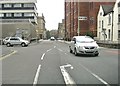
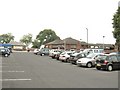
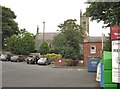
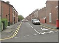
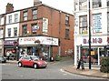
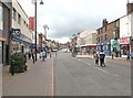
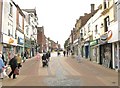
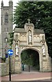
100 photos from this area
Area Information
Key information about the PR7 2DJ including its size, population, and administrative classification.
- Area Type
- Postcode
- Area Size
- 1.7 hectares
- Population
- 1681
- Population Density
- 2113 people/km²
House Prices in PR7 2DJ
22
Properties
£108,434
Average Sold Price
£29,950
Lowest Price
£188,000
Highest Price
Showing 22 properties
| Address | Type | Beds | Baths | Last Sale Price | Last Sale Date | |
|---|---|---|---|---|---|---|
| 97 Devonshire Road, Chorley, PR7 2DJ | Terraced | 3 | 1 | £188,000 | Sep 2024 | |
| 84 Devonshire Road, Chorley, PR7 2DJ | Terraced | 2 | 1 | £150,500 | Jun 2022 | |
| 103 Devonshire Road, Chorley, PR7 2DJ | house | - | - | £170,000 | Jun 2022 | |
| 86 Devonshire Road, Chorley, PR7 2DJ | house | - | - | £138,000 | Dec 2021 | |
| 87 Devonshire Road, Chorley, PR7 2DJ | Terraced | 2 | 1 | £140,000 | Nov 2018 | |
| 128 Devonshire Road, Chorley, PR7 2DJ | house | 2 | - | £103,000 | Dec 2017 | |
| 94 Devonshire Road, Chorley, PR7 2DJ | Terraced | 3 | 2 | £135,000 | Oct 2017 | |
| 92 Devonshire Road, Chorley, PR7 2DJ | Terraced | 3 | 1 | £110,000 | Nov 2016 | |
| 90 Devonshire Road, Chorley, PR7 2DJ | Terraced | 3 | 1 | £90,000 | Sep 2014 | |
| 101 Devonshire Road, Chorley, PR7 2DJ | house | - | - | £146,000 | May 2007 |
Page 1 of 3
Energy Efficiency in PR7 2DJ
Amenities
Schools
| Rank | School | Type | Entry gender | Ages |
|---|
Explore more schools in this area
Go to Schools tabDemographics
Household Size
Two person
most common
Accommodation Type
Houses
most common
Tenure
84
majority
Ethnic Group
White
most common
Religion
N/A
most common
Household Composition
N/A
most common
Age
47
median
Adults (30-64 years)
most common
Household Deprivation
N/A
with no deprivation
NS-SEC
46
in Lower managerial occupations
Explore more demographic insights in this area
Go to Demographics tabPlanning
Planning Constraints
- Flood RiskPremium
- Ramsar Wetland SitesPremium
- Area of Outstanding Natural BeautyPremium
- Protected Nature ReservePremium
- Protected WoodlandPremium