Area Overview for PR7 2AF
Photos of PR7 2AF
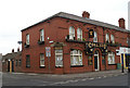
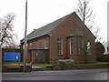

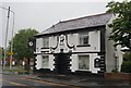
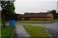
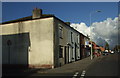
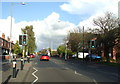
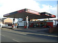
26 photos from this area
Area Information
Key information about the PR7 2AF including its size, population, and administrative classification.
- Area Type
- Postcode
- Area Size
- 6558 m²
- Population
- 1723
- Population Density
- 4487 people/km²
House Prices in PR7 2AF
23
Properties
£164,278
Average Sold Price
£142,000
Lowest Price
£201,000
Highest Price
Showing 23 properties
| Address | Type | Beds | Baths | Last Sale Price | Last Sale Date | |
|---|---|---|---|---|---|---|
| 19 Twickenham Place, Chorley, PR7 2AF | Terraced | 2 | 1 | £165,000 | May 2024 | |
| 3 Twickenham Place, Chorley, PR7 2AF | Semi-detached | 3 | 1 | £185,000 | Dec 2022 | |
| 13 Twickenham Place, Chorley, PR7 2AF | Retail | 3 | 1 | £201,000 | Sep 2022 | |
| 15 Twickenham Place, Chorley, PR7 2AF | Retail | 2 | 1 | £161,000 | Apr 2022 | |
| 12 Twickenham Place, Chorley, PR7 2AF | Retail | 3 | 1 | £174,995 | Mar 2022 | |
| 22 Twickenham Place, Chorley, PR7 2AF | Terraced | 2 | 1 | £142,000 | Jan 2021 | |
| 18 Twickenham Place, Chorley, PR7 2AF | Semi-detached | 3 | 1 | £173,495 | Nov 2020 | |
| 20 Twickenham Place, Chorley, PR7 2AF | Terraced | 3 | 1 | £147,000 | Oct 2018 | |
| 1 Twickenham Place, Chorley, PR7 2AF | Detached | 3 | 1 | £175,000 | Dec 2016 | |
| 9 Twickenham Place, Chorley, PR7 2AF | house | - | - | £149,950 | Aug 2016 |
Page 1 of 3
Energy Efficiency in PR7 2AF
Amenities
Schools
| Rank | School | Type | Entry gender | Ages |
|---|
Explore more schools in this area
Go to Schools tabDemographics
Household Size
Family (3-5 people)
most common
Accommodation Type
Houses
most common
Tenure
65
majority
Ethnic Group
White
most common
Religion
N/A
most common
Household Composition
N/A
most common
Age
47
median
Adults (30-64 years)
most common
Household Deprivation
N/A
with no deprivation
NS-SEC
38
in Lower managerial occupations
Explore more demographic insights in this area
Go to Demographics tabPlanning
Planning Constraints
- Flood RiskPremium
- Ramsar Wetland SitesPremium
- Area of Outstanding Natural BeautyPremium
- Protected Nature ReservePremium
- Protected WoodlandPremium