Area Overview for PR7 1NH
Photos of PR7 1NH


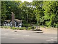
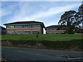
18 photos from this area
Area Information
Key information about the PR7 1NH including its size, population, and administrative classification.
- Area Type
- Postcode
- Area Size
- 29.1 hectares
- Population
- 1350
- Population Density
- 1149 people/km²
House Prices in PR7 1NH
10
Properties
-
Average Sold Price
-
Lowest Price
-
Highest Price
Showing 10 properties
| Address | Type | Beds | Baths | Last Sale Price | Last Sale Date | |
|---|---|---|---|---|---|---|
| Diamond Interiors, Unit 18, Common Bank Industrial Estate, Ackhurst Road, Chorley, PR7 1NH | office_workshop | - | - | - | - | |
| Direct Display And Exhibitions, Unit 20, Common Bank Industrial Estate, Ackhurst Road, Chorley, PR7 1NH | general_industrial | - | - | - | - | |
| Ruttle Plant Hire, Lancaster House, Ackhurst Road, Chorley, PR7 1NH | Industrial | - | - | - | - | |
| 10OFTHOSE, Unit 19, Common Bank Industrial Estate, Ackhurst Road, Chorley, PR7 1NH | general_industrial | - | - | - | - | |
| Unit B, Common Bank Industrial Estate, Ackhurst Road, Chorley, PR7 1NH | warehouse | - | - | - | - | |
| Lloyd And Jones Engineers Ltd, Common Bank Industrial Estate, Ackhurst Road, Chorley, PR7 1NH | Office | - | - | - | - | |
| Hydes Toys And Gifts 1A, Common Bank Industrial Estate, Ackhurst Road, Chorley, PR7 1NH | Retail | - | - | - | - | |
| Thomas Hardie Commercials, Common Bank Industrial Estate, Ackhurst Road, Chorley, PR7 1NH | Industrial | - | - | - | - | |
| Unit F, Ackhurst Road, Chorley, PR7 1NH | Industrial | - | - | - | - | |
| Hillcrest Recycling, Units 3 - 4A, Ackhurst Road, Chorley, PR7 1NH | Industrial | - | - | - | - |
Energy Efficiency in PR7 1NH
Amenities
Schools
| Rank | School | Type | Entry gender | Ages |
|---|
Explore more schools in this area
Go to Schools tabDemographics
Household Size
Two person
most common
Accommodation Type
Houses
most common
Tenure
90
majority
Ethnic Group
White
most common
Religion
N/A
most common
Household Composition
N/A
most common
Age
47
median
Adults (30-64 years)
most common
Household Deprivation
N/A
with no deprivation
NS-SEC
30
in Lower managerial occupations
Explore more demographic insights in this area
Go to Demographics tabPlanning
Planning Constraints
- Flood RiskPremium
- Ramsar Wetland SitesPremium
- Area of Outstanding Natural BeautyPremium
- Protected Nature ReservePremium
- Protected WoodlandPremium