Area Overview for PR7 1HP
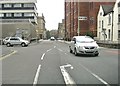
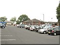
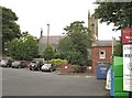
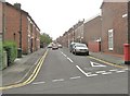
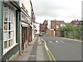
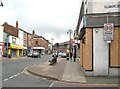
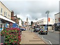
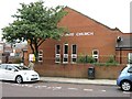
Photos of PR7 1HP
Area Information
Living in PR7 1HP means residing in a very compact residential cluster defined by postcode boundaries. This specific area covers only 8,335 square metres, yet it supports a population of 1,656 people. Such a high concentration indicates a densely populated neighbourhood where residents live in close proximity to their neighbours. You will find that daily life here revolves around immediate local interactions rather than long commutes across vast distances. The area sits within the PR7 postcode sector, serving as a focused pocket of housing within the broader Chorley landscape. The community here is established and mature, reflecting the significant size of the population within such a small footprint. You are stepping into a space where the built environment and the people are tightly integrated. While the total area size is tiny compared to wider boroughs, the number of households ensures a established social fabric. Prospective buyers should note that this is not a sprawling suburban development but a defined cluster of homes. The sheer density means that everything from local shops to public transport links is often immediately accessible without needing a car for basic routines. This postcode serves as a distinct geographical entity within the region, offering a specific set of living conditions tailored to its resident profile. Understanding the extent of PR7 1HP helps you visualise the scale of your future home. You are looking at an area where the ground is utilised efficiently to house a substantial number of families. The character of the area is shaped by this density, creating a neighbourhood feel that persists despite the urban sprawl often seen in surrounding regions.
- Area Type
- Postcode
- Area Size
- 8335 m²
- Population
- 1656
- Population Density
- 7038 people/km²
The property market in PR7 1HP is characterised by a predominance of houses. This accommodation type defines the physical landscape of the postcode and dictates the lifestyle expectations for new buyers. With 51% home ownership, you will find that half of the residents put their own name on the title deeds. This statistic suggests a balanced market where motivated sellers exist alongside long-term owned homes. The remaining 49% rental sector offers an alternative entry point for those wishing to move without immediate purchase commitments. Because this is a small area covering only 8,335 square metres, inventory levels will naturally be low. You cannot expect the wide variety of property types found in larger boroughs. Instead, you are looking at a concentrated stock of houses that serve the local population of 1,656. The high density reinforces the idea that land is at a premium, likely influencing property prices relative to the space available. Buyers should approach this micro-market with realistic expectations regarding supply. The mix of ownership types means you need to be flexible in your search strategy. Some streets may be heavily owned, while others might lean towards private renting. This diversity provides options for different financial situations. However, the sheer number of houses compared to other dwelling types means you do not need to compromise on architectural style if you prefer detached or semi-detached properties. The house-form housing stock is the dominant feature you will see during any viewing tour of PR7 1HP.
House Prices in PR7 1HP
Showing 49 properties
Energy Efficiency in PR7 1HP
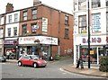
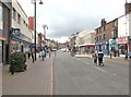
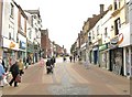
Your daily life in PR7 1HP is supported by a practical selection of amenities within easy reach. Retail options include Booths Chorley and M&S Market, providing access to supermarkets for fresh groceries without the need for long drives. Iceland Chorley is also nearby, offering a strong network for household shopping. These three major retailers ensure that your routine errands can be accomplished from home, saving you significant fuel and time. Rail travel is an integral part of the local lifestyle, supported by five key stations in the immediate vicinity. You have access to Chorley Railway Station, Euxton Balshaw Lane Railway Station, and Buckshaw Parkway Railway Station. These three specific locations offer flexibility if you live on the edge of the postcode or wish to explore different travel routes. The presence of these five stations ensures that you are not isolated from the regional transport network. The residential character of PR7 1HP complements these commercial and transport links. With a population of 1,656 and a median age of 47, the area feels like a settled community. You will find that the local shops cater to the practical needs of families and working adults. The 51% home ownership rate suggests a community invested in local stability. While the area is small, the integration of essential services means you do not need to travel far to meet your households needs.
Amenities
Schools
| Rank | School | Type | Entry gender | Ages |
|---|
Explore more schools in this area
Go to Schools tabDemographics
The community in PR7 1HP is defined by an adult demographic with a median age of 47 years. Most residents fall within the 30 to 64-year age range, indicating a stable population of established families and working professionals. You will find that this area is not dominated by students or empty nesters but primarily working-age individuals. This age profile suggests a neighbourhood where children are likely to be growing up or where parents have settled down with adult children. Home ownership stands at 51% within PR7 1HP. This figure places the area roughly on an even split between owners and renters. For buyers, this indicates a mixed market where没有必要 chase exclusively owner-occupied streets but could find both rental opportunities and homes for sale. The predominant housing type consists of houses, distinguishing this postcode from areas dominated by high-rise flats or terraced rows. This architectural preference aligns with the desire for privacy and space among the older adult demographic. Ethnically, the White group forms the predominant ethnic group in the area. This reflects the broader demographic makeup of many established English towns. The population density reaches 198,678 people per square kilometre, a figure that underscores the intensity of the residential packing within this single postcode. You are looking at an area where every square metre is occupied by a home or essential infrastructure. This high density ensures that services remain within walking distance for the majority of the 1,656 inhabitants.
Household Size
Accommodation Type
Tenure
Ethnic Group
Religion
Household Composition
Age
Household Deprivation
NS-SEC
Explore more demographic insights in this area
Go to Demographics tabPlanning
Planning Constraints
- Flood RiskPremium
- Ramsar Wetland SitesPremium
- Area of Outstanding Natural BeautyPremium
- Protected Nature ReservePremium
- Protected WoodlandPremium