Area Overview for PR6 8TG
Photos of PR6 8TG
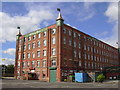
![Blackburn Road [B6228] in PR6 8TG](https://images.propbar.co.uk/images/geograph/22/94/2294601_120.jpg)

29 photos from this area
Area Information
Key information about the PR6 8TG including its size, population, and administrative classification.
- Area Type
- Postcode
- Area Size
- 7.1 hectares
- Population
- 2291
- Population Density
- 1049 people/km²
House Prices in PR6 8TG
29
Properties
£226,891
Average Sold Price
£59,995
Lowest Price
£710,000
Highest Price
Showing 29 properties
| Address | Type | Beds | Baths | Last Sale Price | Last Sale Date | |
|---|---|---|---|---|---|---|
| Knowley House, Guildford Avenue, Chorley, PR6 8TG | Detached | 4 | 2 | £550,000 | Mar 2025 | |
| 29 Guildford Avenue, Chorley, PR6 8TG | house | - | - | £431,756 | Mar 2024 | |
| 23 Guildford Avenue, Chorley, PR6 8TG | Detached | 5 | 4 | £710,000 | Sep 2023 | |
| 10 Guildford Avenue, Chorley, PR6 8TG | Semi-detached | 3 | 1 | £200,000 | May 2023 | |
| 19 Guildford Avenue, Chorley, PR6 8TG | house | - | - | £223,000 | May 2021 | |
| 16 Guildford Avenue, Chorley, PR6 8TG | Detached | 3 | 1 | £195,000 | Mar 2021 | |
| 21 Guildford Avenue, Chorley, PR6 8TG | house | - | - | £180,000 | Nov 2020 | |
| 3 Guildford Avenue, Chorley, PR6 8TG | Semi-detached | 3 | 1 | £171,500 | Jan 2019 | |
| 4 Guildford Avenue, Chorley, PR6 8TG | house | 3 | - | £150,000 | Apr 2011 | |
| 20 Guildford Avenue, Chorley, PR6 8TG | Detached | 3 | 1 | £172,000 | Apr 2006 |
Page 1 of 3
Energy Efficiency in PR6 8TG
Amenities
Schools
| Rank | School | Type | Entry gender | Ages |
|---|
Explore more schools in this area
Go to Schools tabDemographics
Household Size
Two person
most common
Accommodation Type
Houses
most common
Tenure
66
majority
Ethnic Group
White
most common
Religion
N/A
most common
Household Composition
N/A
most common
Age
47
median
Adults (30-64 years)
most common
Household Deprivation
N/A
with no deprivation
NS-SEC
29
in Lower managerial occupations
Explore more demographic insights in this area
Go to Demographics tabPlanning
Planning Constraints
- Flood RiskPremium
- Ramsar Wetland SitesPremium
- Area of Outstanding Natural BeautyPremium
- Protected Nature ReservePremium
- Protected WoodlandPremium