Area Overview for PR6 8AZ
Photos of PR6 8AZ
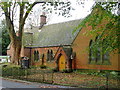
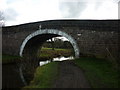

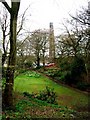
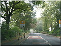
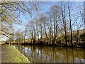
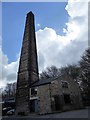
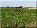
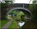
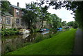
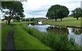
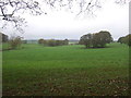
40 photos from this area
Area Information
Key information about the PR6 8AZ including its size, population, and administrative classification.
- Area Type
- Postcode
- Area Size
- 25.3 hectares
- Population
- 1349
- Population Density
- 179 people/km²
House Prices in PR6 8AZ
24
Properties
£456,995
Average Sold Price
£135,000
Lowest Price
£1,350,000
Highest Price
Showing 24 properties
| Address | Type | Beds | Baths | Last Sale Price | Last Sale Date | |
|---|---|---|---|---|---|---|
| The Stables, Withnell Fold, Withnell, PR6 8AZ | Detached | 4 | 2 | £350,000 | Apr 2023 | |
| Hallatrow, The Close, Withnell Fold, Withnell, PR6 8AZ | Retail | 4 | 4 | £670,000 | Sep 2022 | |
| The Old House, Withnell Fold, Withnell, PR6 8AZ | Detached | 5 | 5 | £1,350,000 | Aug 2022 | |
| Chapel House, Withnell Fold, Withnell, PR6 8AZ | house | 3 | 1 | £380,000 | Sep 2019 | |
| Withy Knoll, Withnell Fold, Withnell, PR6 8AZ | house | - | - | £650,000 | Aug 2010 | |
| Merefield, The Close, Withnell Fold, Withnell, PR6 8AZ | house | - | - | £360,000 | Jul 2010 | |
| Far Riding, The Close, Withnell Fold, Withnell, PR6 8AZ | Detached | - | - | £320,000 | Nov 2007 | |
| Sunley Rains, Withnell Fold, Withnell, PR6 8AZ | Detached | - | - | £189,950 | Sep 2002 | |
| Ashmere, The Close, Withnell Fold, Withnell, PR6 8AZ | house | - | - | £165,000 | Jul 2001 | |
| Summerfield, The Close, Withnell Fold, Withnell, PR6 8AZ | Semi-detached | - | - | £135,000 | Jun 1995 |
Page 1 of 3
Energy Efficiency in PR6 8AZ
Amenities
Schools
| Rank | School | Type | Entry gender | Ages |
|---|
Explore more schools in this area
Go to Schools tabDemographics
Household Size
Two person
most common
Accommodation Type
Houses
most common
Tenure
87
majority
Ethnic Group
White
most common
Religion
N/A
most common
Household Composition
N/A
most common
Age
47
median
Adults (30-64 years)
most common
Household Deprivation
N/A
with no deprivation
NS-SEC
48
in Lower managerial occupations
Explore more demographic insights in this area
Go to Demographics tabPlanning
Planning Constraints
- Flood RiskPremium
- Ramsar Wetland SitesPremium
- Area of Outstanding Natural BeautyPremium
- Protected Nature ReservePremium
- Protected WoodlandPremium