Area Overview for PR6 7UT
Photos of PR6 7UT


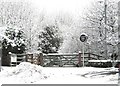
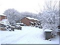
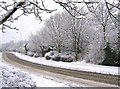


72 photos from this area
Area Information
Key information about the PR6 7UT including its size, population, and administrative classification.
- Area Type
- Postcode
- Area Size
- 2.3 hectares
- Population
- 1373
- Population Density
- 1197 people/km²
House Prices in PR6 7UT
44
Properties
£124,261
Average Sold Price
£35,000
Lowest Price
£346,770
Highest Price
Showing 44 properties
| Address | Type | Beds | Baths | Last Sale Price | Last Sale Date | |
|---|---|---|---|---|---|---|
| 48 Black Croft, Clayton Le Woods, PR6 7UT | Semi-detached | 2 | 1 | £154,995 | Mar 2025 | |
| 38 Black Croft, Clayton Le Woods, PR6 7UT | Terraced | 2 | 1 | £124,750 | Dec 2024 | |
| 76 Black Croft, Clayton Le Woods, PR6 7UT | Bungalow | 3 | 2 | £346,770 | Aug 2024 | |
| 42 Black Croft, Clayton Le Woods, PR6 7UT | Semi-detached | 2 | 1 | £120,000 | Jul 2024 | |
| 60 Black Croft, Clayton Le Woods, PR6 7UT | Bungalow | 2 | 1 | £229,995 | Mar 2024 | |
| 58 Black Croft, Clayton Le Woods, PR6 7UT | Bungalow | 3 | 1 | £320,000 | Jul 2022 | |
| 39 Black Croft, Clayton Le Woods, PR6 7UT | Semi-detached | 2 | 1 | £112,000 | Aug 2020 | |
| 74 Black Croft, Clayton Le Woods, PR6 7UT | Semi-detached | 3 | 1 | £154,000 | Jul 2020 | |
| 62 Black Croft, Clayton Le Woods, PR6 7UT | Bungalow | 3 | 1 | £205,000 | Jul 2019 | |
| 63 Black Croft, Clayton Le Woods, PR6 7UT | Bungalow | 2 | 1 | £167,000 | Aug 2018 |
Page 1 of 5
Energy Efficiency in PR6 7UT
Amenities
Schools
| Rank | School | Type | Entry gender | Ages |
|---|
Explore more schools in this area
Go to Schools tabDemographics
Household Size
One person
most common
Accommodation Type
Houses
most common
Tenure
84
majority
Ethnic Group
White
most common
Religion
N/A
most common
Household Composition
N/A
most common
Age
47
median
Adults (30-64 years)
most common
Household Deprivation
N/A
with no deprivation
NS-SEC
44
in Lower managerial occupations
Explore more demographic insights in this area
Go to Demographics tabPlanning
Planning Constraints
- Flood RiskPremium
- Ramsar Wetland SitesPremium
- Area of Outstanding Natural BeautyPremium
- Protected Nature ReservePremium
- Protected WoodlandPremium