Area Overview for PR5 8HA
Photos of PR5 8HA
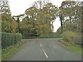
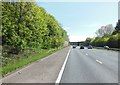
![Westwood Road [B5256] and the junction with Clayton Brook Road in PR5 8HA](https://images.propbar.co.uk/images/geograph/20/24/2024320_120.jpg)
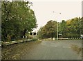
![Sandy Lane [B5256] and the junction with Holt Lane in PR5 8HA](https://images.propbar.co.uk/images/geograph/20/24/2024328_120.jpg)
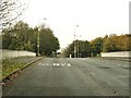
![Sandy Lane [B5256] approaching the junction with Holt Lane in PR5 8HA](https://images.propbar.co.uk/images/geograph/20/26/2026113_120.jpg)
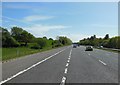
![Westwood Road [B5256] approaching the junction with Clayton Brook Road in PR5 8HA](https://images.propbar.co.uk/images/geograph/20/26/2026135_120.jpg)
47 photos from this area
Area Information
Key information about the PR5 8HA including its size, population, and administrative classification.
- Area Type
- Postcode
- Area Size
- 7823 m²
- Population
- 1382
- Population Density
- 4234 people/km²
House Prices in PR5 8HA
21
Properties
£69,500
Average Sold Price
£54,000
Lowest Price
£85,000
Highest Price
Showing 21 properties
| Address | Type | Beds | Baths | Last Sale Price | Last Sale Date | |
|---|---|---|---|---|---|---|
| 40 Seven Acres, Bamber Bridge, PR5 8HA | house | 3 | - | £85,000 | Jul 2012 | |
| 58 Seven Acres, Bamber Bridge, PR5 8HA | house | - | - | £54,000 | Oct 2009 | |
| 47 Seven Acres, Bamber Bridge, PR5 8HA | house | - | - | - | - | |
| 52 Seven Acres, Bamber Bridge, PR5 8HA | house | - | - | - | - | |
| 50 Seven Acres, Bamber Bridge, PR5 8HA | house | - | - | - | - | |
| 43 Seven Acres, Bamber Bridge, PR5 8HA | house | - | - | - | - | |
| 46 Seven Acres, Bamber Bridge, PR5 8HA | house | - | - | - | - | |
| 45 Seven Acres, Bamber Bridge, PR5 8HA | house | - | - | - | - | |
| 54 Seven Acres, Bamber Bridge, PR5 8HA | house | - | - | - | - | |
| 51 Seven Acres, Bamber Bridge, PR5 8HA | house | - | - | - | - |
Page 1 of 3
Energy Efficiency in PR5 8HA
Amenities
Schools
| Rank | School | Type | Entry gender | Ages |
|---|
Explore more schools in this area
Go to Schools tabDemographics
Household Size
One person
most common
Accommodation Type
Houses
most common
Tenure
29
majority
Ethnic Group
White
most common
Religion
N/A
most common
Household Composition
N/A
most common
Age
47
median
Adults (30-64 years)
most common
Household Deprivation
N/A
with no deprivation
NS-SEC
19
in Lower managerial occupations
Explore more demographic insights in this area
Go to Demographics tabPlanning
Planning Constraints
- Flood RiskPremium
- Ramsar Wetland SitesPremium
- Area of Outstanding Natural BeautyPremium
- Protected Nature ReservePremium
- Protected WoodlandPremium