Area Overview for PR5 8DF
Photos of PR5 8DF


Area Information
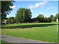
Living in PR5 8DF offers a glimpse into a compact residential cluster within Lancashire, England. This specific postcode covers a small community with just 1,178 residents, creating a tight-knit environment where neighbours know one another. The area functions as a practical hub for those working in the wider region, balancing the quiet of a residential street with essential services close by. Prospective homebuyers will find this location distinct for its scale; it is not a sprawling development but a defined cluster with clear boundaries. Daily life here revolves around walkable access to fundamental amenities like retail outlets and rail connections. The character of PR5 8DF is defined by its density relative to the local population, ensuring that you do not travel far for essential needs. You will notice a community focused on stability rather than rapid change, making it ideal for those seeking a settled home rather than a high-energy city centre. The area provides a straightforward living experience where the distance to facilities is short and the sense of place is anchored by local landmarks and transport links.
- Area Type
- Postcode
- Area Size
- Not available
- Population
- 1178
- Population Density
- 4872 people/km²
The property market in PR5 8DF is defined by a specific housing stock and a lower-than-average rate of home ownership. Only 31 per cent of residents own their homes outright or with a mortgage, which points to a significant rental sector alongside the housing supply. Houses dominate the accommodation type profile for this area, meaning you will mostly encounter detached or semi-detached properties rather than flats or bungalows. This preference for houses suggests a market appeal to families or individuals seeking more space within the residential cluster. With a population of 1,178, the total number of properties is relatively small, which can mean faster transaction times or greater local knowledge among buyers. The low home ownership percentage might indicate that many residents are tenants looking for flexibility or renters on shorter-term contracts. For a buyer entering this market, the availability of houses creates a direct suit for those moving from larger urban environments. You should expect a market where practical living space and house availability are key drivers for any potential sale.
House Prices in PR5 8DF
No properties found in this postcode.
Energy Efficiency in PR5 8DF
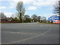
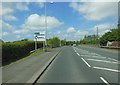
Your lifestyle in PR5 8DF centres around convenient access to major retail sites and Transport links. Within practical reach, you have five supermarkets to choose from, including Asda Clayton, Morrisons Daily Clayton, and a second Asda Clayton site. These grocery stores are located near the residential cluster, allowing you to handle weekly shopping without traveling far. Rail travel is equally accessible, with five stations operating in the vicinity of the postcode. Bamber Bridge Railway Station, Lostock Hall Railway Station, and Leyland Railway Station provide regular services that integrate well into your daily routine. This arrangement means you can combine a local supermarket run with a train commute or school run efficiently. The proximity of these utilities creates a lifestyle where essential errands require little planning or driving. You will find that the daily rhythm of PR5 8DF is supported by the immediate availability of food and transport, ensuring that routine tasks remain simple and stress-free.
Amenities
Schools
| Rank | School | Type | Entry gender | Ages |
|---|
Explore more schools in this area
Go to Schools tabDemographics
You will find that the community in PR5 8DF is predominantly composed of adults aged between 30 and 64 years. This age bracket forms the heart of the local population, suggesting a neighbourhood where established families and working professionals reside. The median age here is 47 years, confirming that the demographic skew towards middle age is significant. Only 31 per cent of residents are homeowners, indicating that rentals likely play a major role in the local accommodation mix. Houses remain the preferred style of dwelling across the area, serving as the standard for the majority of households. While the predominant ethnic group is White, the social fabric is shaped primarily by these age and housing factors rather than ethnic diversity. The high concentration of adults in the 30 to 64 range often correlates with a stable community where people have already put down roots. This profile suggests that the local schools will cater largely to school-aged children, while healthcare and leisure facilities will meet the needs of an adult population.
Household Size
Accommodation Type
Tenure
Ethnic Group
Religion
Household Composition
Age
Household Deprivation
NS-SEC
Explore more demographic insights in this area
Go to Demographics tabPlanning
Planning Constraints
- Flood RiskPremium
- Ramsar Wetland SitesPremium
- Area of Outstanding Natural BeautyPremium
- Protected Nature ReservePremium
- Protected WoodlandPremium