Area Overview for PR5 6WX
Photos of PR5 6WX

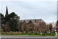

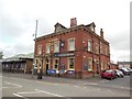
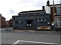
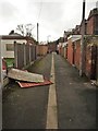
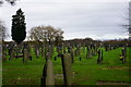
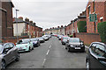
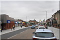
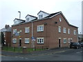
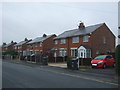
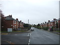
36 photos from this area
Area Information
Key information about the PR5 6WX including its size, population, and administrative classification.
- Area Type
- Postcode
- Area Size
- 9942 m²
- Population
- 1406
- Population Density
- 5286 people/km²
House Prices in PR5 6WX
26
Properties
£147,103
Average Sold Price
£59,995
Lowest Price
£230,000
Highest Price
Showing 26 properties
| Address | Type | Beds | Baths | Last Sale Price | Last Sale Date | |
|---|---|---|---|---|---|---|
| 12 Withy Grove Crescent, Bamber Bridge, PR5 6WX | Bungalow | 2 | 1 | £147,500 | Feb 2024 | |
| 24 Withy Grove Crescent, Bamber Bridge, PR5 6WX | Retail | 2 | 1 | £230,000 | Sep 2022 | |
| 44 Withy Grove Crescent, Bamber Bridge, PR5 6WX | Bungalow | 3 | 1 | £174,950 | Sep 2021 | |
| 2 Withy Grove Crescent, Bamber Bridge, PR5 6WX | house | - | - | £160,000 | Mar 2021 | |
| 32 Withy Grove Crescent, Bamber Bridge, PR5 6WX | house | - | - | £175,000 | Nov 2020 | |
| 46 Withy Grove Crescent, Bamber Bridge, PR5 6WX | Bungalow | 2 | 1 | £148,000 | Jul 2020 | |
| 38 Withy Grove Crescent, Bamber Bridge, PR5 6WX | Bungalow | 3 | - | £119,500 | Jun 2016 | |
| 16 Withy Grove Crescent, Bamber Bridge, PR5 6WX | Semi-detached | 3 | 1 | £138,000 | Feb 2016 | |
| 20 Withy Grove Crescent, Bamber Bridge, PR5 6WX | house | 3 | - | £140,000 | Jul 2015 | |
| 40 Withy Grove Crescent, Bamber Bridge, PR5 6WX | Semi-detached | 2 | - | £120,000 | May 2015 |
Page 1 of 3
Energy Efficiency in PR5 6WX
Amenities
Schools
| Rank | School | Type | Entry gender | Ages |
|---|
Explore more schools in this area
Go to Schools tabDemographics
Household Size
Family (3-5 people)
most common
Accommodation Type
Houses
most common
Tenure
56
majority
Ethnic Group
White
most common
Religion
N/A
most common
Household Composition
N/A
most common
Age
47
median
Adults (30-64 years)
most common
Household Deprivation
N/A
with no deprivation
NS-SEC
22
in Lower managerial occupations
Explore more demographic insights in this area
Go to Demographics tabPlanning
Planning Constraints
- Flood RiskPremium
- Ramsar Wetland SitesPremium
- Area of Outstanding Natural BeautyPremium
- Protected Nature ReservePremium
- Protected WoodlandPremium