Area Overview for PR5 5UA
Photos of PR5 5UA
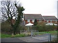
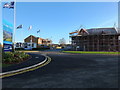
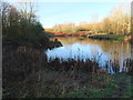

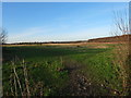


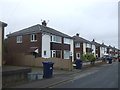
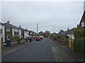


19 photos from this area
Area Information
Key information about the PR5 5UA including its size, population, and administrative classification.
- Area Type
- Postcode
- Area Size
- 4.0 hectares
- Population
- 2026
- Population Density
- 2905 people/km²
House Prices in PR5 5UA
27
Properties
£160,553
Average Sold Price
£34,000
Lowest Price
£300,000
Highest Price
Showing 27 properties
| Address | Type | Beds | Baths | Last Sale Price | Last Sale Date | |
|---|---|---|---|---|---|---|
| 107 Wateringpool Lane, Lostock Hall, PR5 5UA | Semi-detached | 3 | 1 | £235,000 | Oct 2025 | |
| 109 Wateringpool Lane, Lostock Hall, PR5 5UA | Semi-detached | 2 | 1 | £179,500 | Aug 2024 | |
| 90 Wateringpool Lane, Lostock Hall, PR5 5UA | house | - | - | £165,100 | Jun 2021 | |
| 74 Wateringpool Lane, Lostock Hall, PR5 5UA | Bungalow | 2 | 1 | £170,000 | Jul 2020 | |
| 66 Wateringpool Lane, Lostock Hall, PR5 5UA | Bungalow | 3 | 2 | £210,000 | Jan 2020 | |
| 83 Wateringpool Lane, Lostock Hall, PR5 5UA | Semi-detached | 3 | 1 | £177,500 | Dec 2017 | |
| 119 Wateringpool Lane, Lostock Hall, PR5 5UA | Semi-detached | 4 | 2 | £189,950 | Sep 2016 | |
| 113 Wateringpool Lane, Lostock Hall, PR5 5UA | Semi-detached | 2 | 1 | £136,000 | Nov 2015 | |
| 64 Wateringpool Lane, Lostock Hall, PR5 5UA | Semi-detached | 5 | 1 | £179,950 | Jul 2014 | |
| 85 Wateringpool Lane, Lostock Hall, PR5 5UA | Semi-detached | - | - | £300,000 | Apr 2012 |
Page 1 of 3
Energy Efficiency in PR5 5UA
Amenities
Schools
| Rank | School | Type | Entry gender | Ages |
|---|
Explore more schools in this area
Go to Schools tabDemographics
Household Size
Family (3-5 people)
most common
Accommodation Type
Houses
most common
Tenure
88
majority
Ethnic Group
White
most common
Religion
N/A
most common
Household Composition
N/A
most common
Age
47
median
Adults (30-64 years)
most common
Household Deprivation
N/A
with no deprivation
NS-SEC
36
in Lower managerial occupations
Explore more demographic insights in this area
Go to Demographics tabPlanning
Planning Constraints
- Flood RiskPremium
- Ramsar Wetland SitesPremium
- Area of Outstanding Natural BeautyPremium
- Protected Nature ReservePremium
- Protected WoodlandPremium